
Magnitude |
:3 |
| Date & Time (UTC) | 2012-11-11 20:42:03.2 |
| Date & Time (Local) | 1391/8/22 00:12:03.2 |
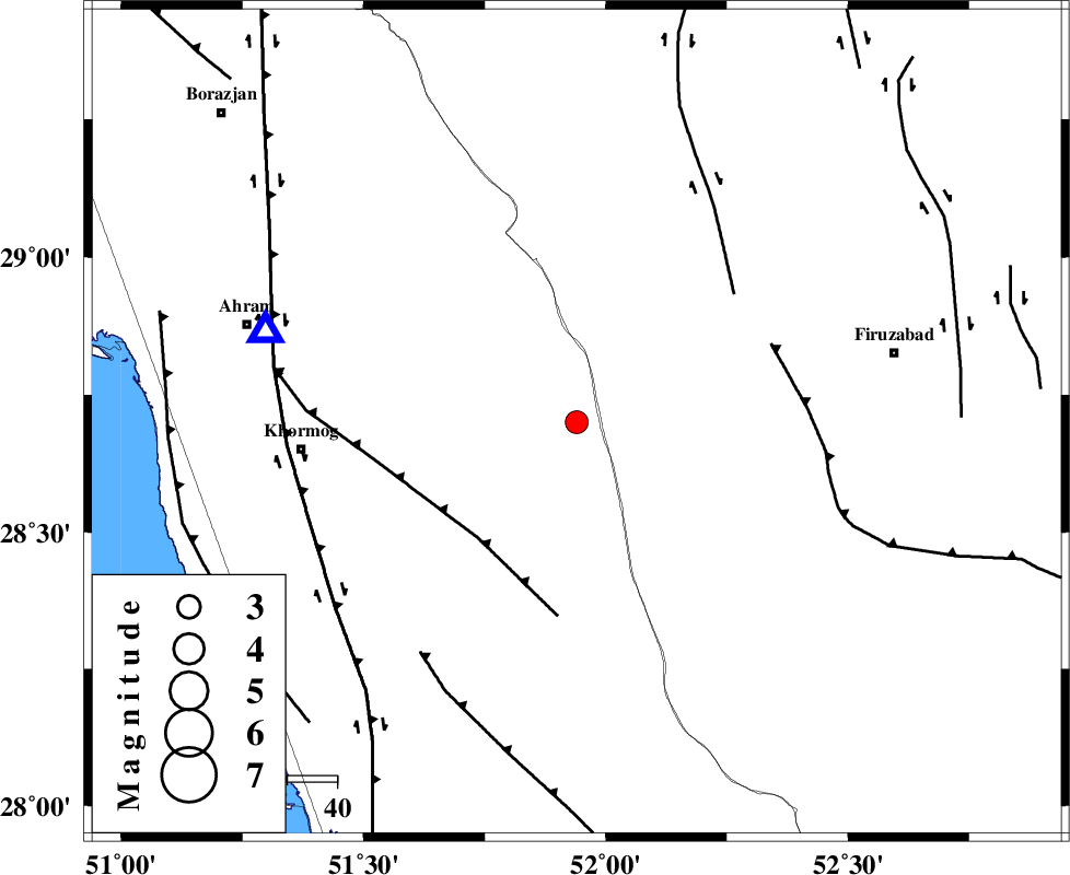
| Location | Lat:28.7 Lon: 51.94 |
| Region | Bushehr Province, 24 km South-West of Farashband |
Nearest Cities |
|
| 24 km South West of Farashband, Fars Province | |
| 27 km South West of Aviz, Fars Province | |
| 39 km North East of Shanbeh, Bushehr Province | |
| 43 km North West of Dahrom, Fars Province | |
| 46 km South of Nujin, Fars Province | |
| Depth | 9 km |
| Agency | |
Faults within 150 km: |
|
| MFF5 (Length: 74 km) , Distance to epicenter: 31 km | |
| KAREBASS_F (Length: 98 km) , Distance to epicenter: 41 km | |
| QIR_F (Length: 130 km) , Distance to epicenter: 42 km | |
| Number of Phases | 6 |
| RMS | 0 |
| Number of Stations | 4 |
| Error in Latitude | >3.2 km |
| Error in Longitude | 2.1 km |
| Error in Depth | 3.6 km |
Download waveform in seisan format
to download seisan software Click here
to access information about IIEES stations Click here
Amplitude | ||||||||
| UID | Agency | Station | Component | Amplitude | Period | Arrival Time | Proccessing Time | Signal Clip |
| 86978 | IIEES | GHIR | N | 426.7 | 0.44 | 2012-11-11 20:42:48 | 2012-11-12 02:16:00 | n |
Phase | ||||||||||||
| Agency | Station | Component | Phase Type | Phase Quality | First Motion | Observed Arrival Time | Time Residual | Loc. Flag | Input Weight | Distance | Azimuth | |
| IIEES | AHRM | Z | Pg | E | 2012-11-11 20:42:14 | -0.08 | y | 65.4 | 287 | |||
| IIEES | AHRM | N | Sg | E | 2012-11-11 20:42:23 | 0.06 | y | 65.4 | 287 | |||
| IIEES | GHIR | Z | Pg | E | 2012-11-11 20:42:22 | 0.01 | y | 112 | 114 | |||
| IIEES | GHIR | E | S | E | 2012-11-11 20:42:36 | 0 | y | 112 | 114 | |||
| IIEES | YZKH | Z | Pn | E | 2012-11-11 20:43:11 | 0.03 | y | 482 | 31 | |||
| IIEES | KHMZ | Z | Pn | E | 2012-11-11 20:43:24 | -0.03 | y | 590 | 342 | |||