
Magnitude |
:2.9 |
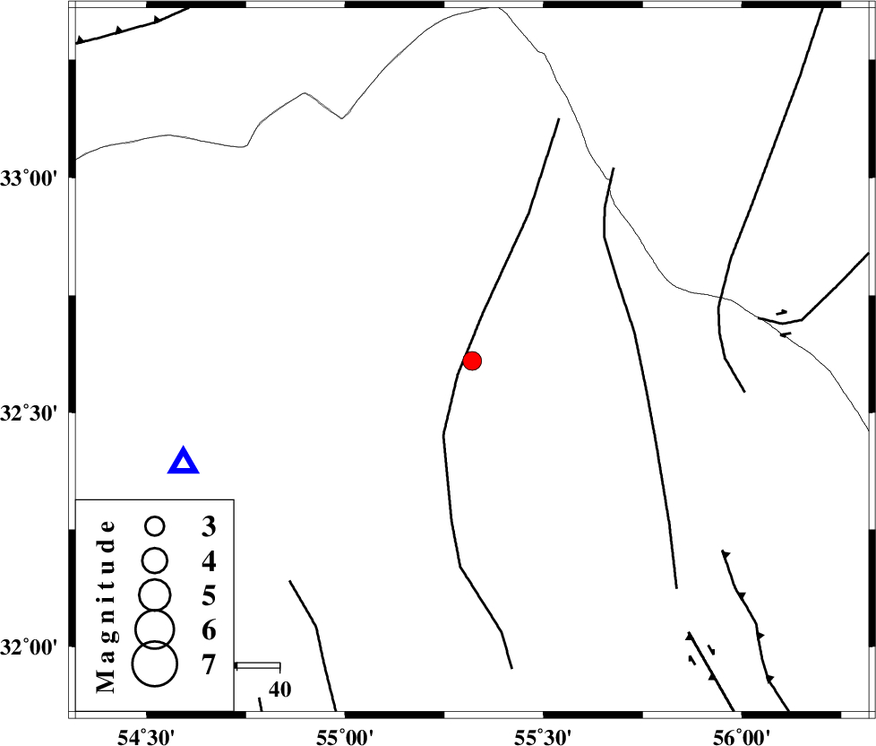
| Date & Time (UTC) | 2012-11-05 16:36:43.4 |
| Date & Time (Local) | 1391/8/15 20:06:43.4 |
| Location | Lat:32.61 Lon: 55.32 |
| Region | Yazd Province, 112 km North of Bafq |
Nearest Cities |
|
| 51 km South West of Robat-e posht-e badam, Yazd Province | |
| 63 km South East of Zarrin, Yazd Province | |
| 66 km South East of Hajiabad, Yazd Province | |
| 69 km North East of Kharaneq, Yazd Province | |
| 85 km North East of Tut, Yazd Province | |
| Depth | 32 km |
| Agency | |
Faults within 150 km: |
|
| POSHT_E_BADAM_F (Length: 128 km) , Distance to epicenter: 5 km | |
| SARBALA_F (Length: 92 km) , Distance to epicenter: 39 km | |
| NAINI_F (Length: 342 km) , Distance to epicenter: 59 km | |
| Number of Phases | 5 |
| RMS | 0.3 |
| Number of Stations | 3 |
| Error in Latitude | >2.4 km |
| Error in Longitude | 3.4 km |
| Error in Depth | 5.3 km |
Download waveform in seisan format
to download seisan software Click here
to access information about IIEES stations Click here
Amplitude | ||||||||
| UID | Agency | Station | Component | Amplitude | Period | Arrival Time | Proccessing Time | Signal Clip |
| 86834 | IIEES | KRBR | N | 42.3 | 0.52 | 2012-11-05 16:38:20 | 2012-11-05 04:06:00 | n |
Phase | ||||||||||||
| Agency | Station | Component | Phase Type | Phase Quality | First Motion | Observed Arrival Time | Time Residual | Loc. Flag | Input Weight | Distance | Azimuth | |
| IIEES | YZKH | Z | Pg | E | 2012-11-05 16:36:56 | 0 | y | 72.9 | 250 | |||
| IIEES | TABS | Z | Pn | E | 2012-11-05 16:37:14 | -0.33 | y | 203 | 55 | |||
| IIEES | TABS | N | Sg | E | 2012-11-05 16:37:40 | 0.15 | y | 203 | 55 | |||
| IIEES | KRBR | Z | Pn | E | 2012-11-05 16:37:30 | 0.39 | y | 322 | 154 | |||
| IIEES | KRBR | N | Sg | E | 2012-11-05 16:38:11 | -0.18 | y | 322 | 154 | |||