
Magnitude |
:2 |
| Date & Time (UTC) | 2012-10-31 09:21:58.2 |
| Date & Time (Local) | 1391/8/10 12:51:58.2 |
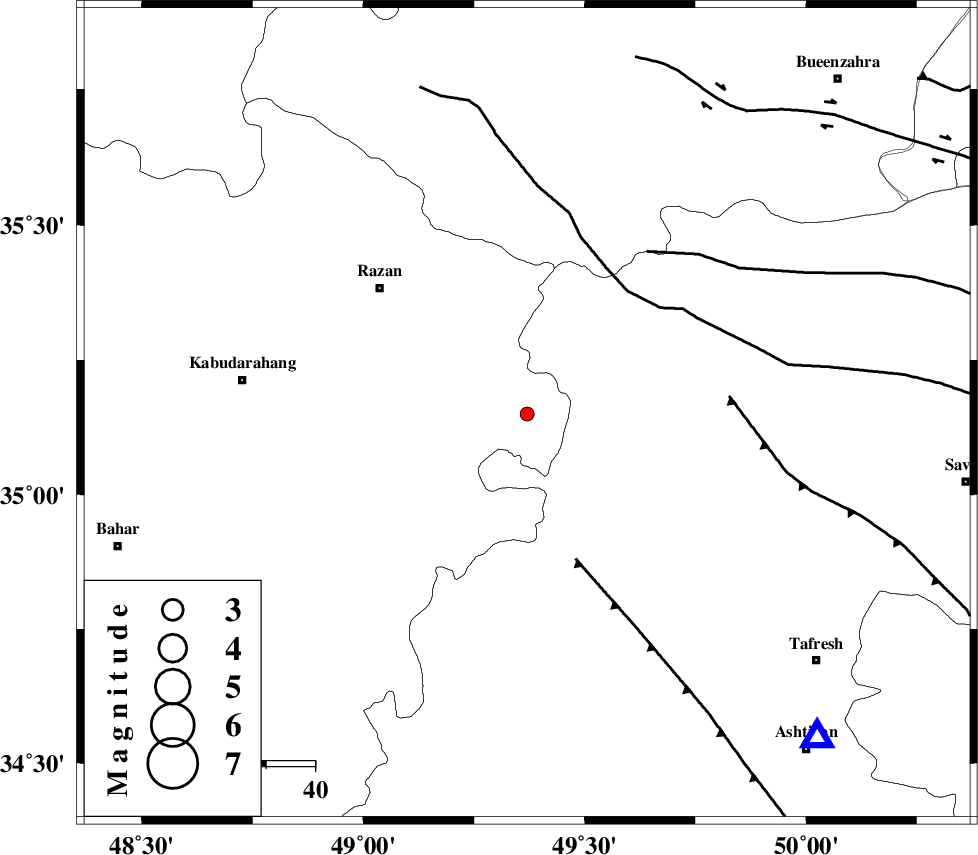
| Location | Lat:35.15 Lon: 49.37 |
| Region | Hamedan Province, 40 km South-East of Razan |
Nearest Cities |
|
| 10 km North East of Tajrak, Hamedan Province | |
| 19 km West of Yatan, Markazi Province | |
| 19 km South of Suzan, Hamedan Province | |
| 28 km North East of Asleh, Hamedan Province | |
| 29 km South East of Gorvey-edarjezin, Hamedan Province | |
| Depth | 15 km |
| Agency | |
Faults within 150 km: |
|
| TAFRESH_F (Length: 117 km) , Distance to epicenter: 32 km | |
| KUSHK_E_NOSRAT_F (Length: 230 km) , Distance to epicenter: 33 km | |
| S_PARANDAK_F (Length: 116 km) , Distance to epicenter: 41 km | |
| Number of Phases | 7 |
| RMS | 0.3 |
| Number of Stations | 5 |
| Error in Latitude | >3.1 km |
| Error in Longitude | 3.9 km |
| Error in Depth | 8.8 km |
Download waveform in seisan format
to download seisan software Click here
to access information about IIEES stations Click here
Amplitude | ||||||||
| UID | Agency | Station | Component | Amplitude | Period | Arrival Time | Proccessing Time | Signal Clip |
| 86784 | IIEES | GHVR | E | 15.6 | 0.26 | 2012-10-31 09:22:54 | 2012-10-31 09:27:00 | n |
| 86785 | IIEES | GHVR | N | 21 | 0.26 | 2012-10-31 09:22:54 | 2012-10-31 09:27:00 | n |
Phase | ||||||||||||
| Agency | Station | Component | Phase Type | Phase Quality | First Motion | Observed Arrival Time | Time Residual | Loc. Flag | Input Weight | Distance | Azimuth | |
| IIEES | ASAO | Z | Pg | E | 2012-10-31 09:22:13 | -0.14 | y | 89.7 | 138 | |||
| IIEES | KHMZ | Z | Pg | E | 2012-10-31 09:22:26 | 0.34 | y | 166 | 161 | |||
| IIEES | KHMZ | E | Sg | E | 2012-10-31 09:22:45 | -0.07 | y | 166 | 161 | |||
| IIEES | CHTH | Z | Pg | E | 2012-10-31 09:22:28 | 0.16 | y | 180 | 62 | |||
| IIEES | SNGE | Z | Pg | E | 2012-10-31 09:22:28 | 0.03 | y | 185 | 269 | |||
| IIEES | GHVR | Z | Pg | E | 2012-10-31 09:22:28 | -0.66 | y | 187 | 113 | |||
| IIEES | GHVR | N | S | E | 2012-10-31 09:22:50 | 0.33 | y | 187 | 113 | |||