
Magnitude |
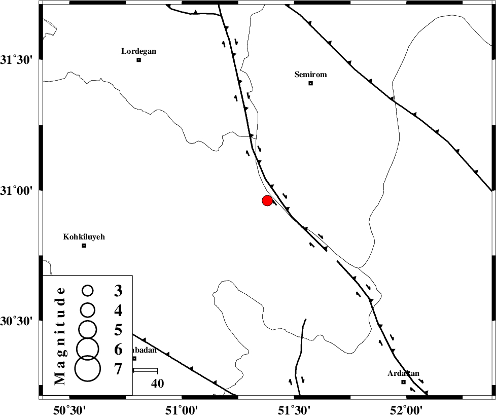
:2.9 |
| Date & Time (UTC) | 2012-10-27 02:22:46.9 |
| Date & Time (Local) | 1391/8/6 05:52:46.9 |
| Location | Lat:30.96 Lon: 51.38 |
| Region | Kohkiluieh va boyerahmad Province, 12 km Sisakht |
Nearest Cities |
|
| 13 km North of Sisakht, Kohkiluieh va boyerahmad Province | |
| 17 km North of Kerik, Kohkiluieh va boyerahmad Province | |
| 21 km North of Chitab, Kohkiluieh va boyerahmad Province | |
| 23 km South East of Meymand, Kohkiluieh va boyerahmad Province | |
| 24 km South West of Kameh, Esfahan Province | |
| Depth | 14 km |
| Agency | |
Faults within 150 km: |
|
| DENA_F (Length: 137 km) , Distance to epicenter: 9 km | |
| HZF3 (Length: 197 km) , Distance to epicenter: 39 km | |
| KAZERUN_F (Length: 96 km) , Distance to epicenter: 53 km | |
| Number of Phases | 5 |
| RMS | 0.1 |
| Number of Stations | 3 |
| Error in Latitude | >3.4 km |
| Error in Longitude | 4.5 km |
| Error in Depth | 7.7 km |
Download waveform in seisan format
to download seisan software Click here
to access information about IIEES stations Click here
Amplitude | ||||||||
| UID | Agency | Station | Component | Amplitude | Period | Arrival Time | Proccessing Time | Signal Clip |
| 86737 | IIEES | AHRM | N | 92.1 | 0.52 | 2012-10-27 02:23:58 | 2012-10-27 04:25:00 | n |
| 86738 | IIEES | GHIR | E | 39.7 | 0.76 | 2012-10-27 02:24:31 | 2012-10-27 04:25:00 | n |
Phase | ||||||||||||
| Agency | Station | Component | Phase Type | Phase Quality | First Motion | Observed Arrival Time | Time Residual | Loc. Flag | Input Weight | Distance | Azimuth | |
| IIEES | AHRM | Z | Pn | E | 2012-10-27 02:23:23 | 0.01 | y | 232 | 182 | |||
| IIEES | AHRM | N | Sg | E | 2012-10-27 02:23:52 | -0.06 | y | 232 | 182 | |||
| IIEES | GHIR | Z | P | E | 2012-10-27 02:23:36 | 0.13 | y | 334 | 152 | |||
| IIEES | GHIR | E | Sg | E | 2012-10-27 02:24:20 | -0.01 | y | 334 | 152 | |||
| IIEES | YZKH | Z | Pn | E | 2012-10-27 02:23:37 | -0.07 | y | 343 | 62 | |||