
Magnitude |
:2.6 |
| Date & Time (UTC) | 2012-10-26 00:02:34.3 |
| Date & Time (Local) | 1391/8/5 03:32:34.3 |
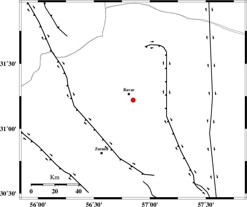
| Location | Lat:31.22 Lon: 56.85 |
| Region | Kerman Province, 6 km Ravar |
Nearest Cities |
|
| 6 km of Ravar, Kerman Province | |
| 13 km South of Dehali, Kerman Province | |
| 32 km North East of Ahmadi, Kerman Province | |
| 33 km North East of Dasht-e khak, Kerman Province | |
| 42 km North East of Toghroljerd, Kerman Province | |
| Depth | 14 km |
| Agency | |
Faults within 150 km: |
|
| LAKARKUH_F (Length: 138 km) , Distance to epicenter: 32 km | |
| KUHBANAN_F (Length: 189 km) , Distance to epicenter: 41 km | |
| NAYBAND_F (Length: 258 km) , Distance to epicenter: 68 km | |
| Number of Phases | 6 |
| RMS | 0.4 |
| Number of Stations | 4 |
| Error in Latitude | >3.1 km |
| Error in Longitude | 3.2 km |
| Error in Depth | 8.8 km |
Download waveform in seisan format
to download seisan software Click here
to access information about IIEES stations Click here
Amplitude | ||||||||
| UID | Agency | Station | Component | Amplitude | Period | Arrival Time | Proccessing Time | Signal Clip |
| 86729 | IIEES | KRBR | N | 93 | 0.24 | 2012-10-26 00:03:16 | 2012-10-26 01:03:00 | n |
| 86730 | IIEES | YZKH | N | 28.8 | 0.28 | 2012-10-26 00:03:47 | 2012-10-26 01:03:00 | n |
| 86731 | IIEES | YZKH | E | 62.8 | 0.44 | 2012-10-26 00:03:48 | 2012-10-26 01:03:00 | n |
Phase | ||||||||||||
| Agency | Station | Component | Phase Type | Phase Quality | First Motion | Observed Arrival Time | Time Residual | Loc. Flag | Input Weight | Distance | Azimuth | |
| IIEES | KRBR | Z | Pg | E | 2012-10-26 00:02:57 | -0.32 | y | 137 | 184 | |||
| IIEES | BSRN | Z | Pn | E | 2012-10-26 00:03:10 | 0.04 | y | 231 | 68 | |||
| IIEES | BSRN | E | Sg | E | 2012-10-26 00:03:40 | 0.14 | y | 231 | 68 | |||
| IIEES | YZKH | N | Sg | E | 2012-10-26 00:03:45 | 0.17 | y | 250 | 302 | |||
| IIEES | TABS | Z | Pn | E | 2012-10-26 00:03:16 | 0.58 | y | 271 | 5 | |||
| IIEES | TABS | E | Sg | E | 2012-10-26 00:03:50 | -0.61 | y | 271 | 5 | |||