
Magnitude |
:3.3 |
| Date & Time (UTC) | 2012-10-25 07:39:41.4 |
| Date & Time (Local) | 1391/8/4 11:09:41.4 |
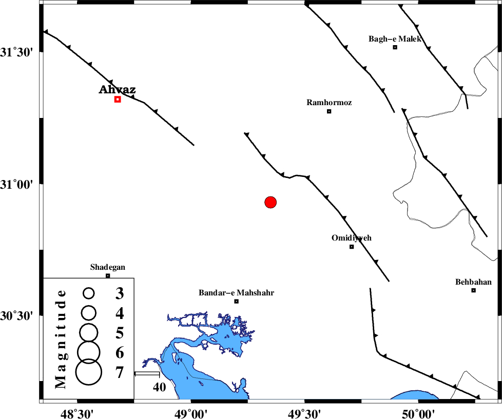
| Location | Lat:30.93 Lon: 49.35 |
| Region | Khoozestan Province, 39 km North-West of Omidiyeh |
Nearest Cities |
|
| 6 km North of Ramshir, Khoozestan Province | |
| 11 km of Meshrageh, Khoozestan Province | |
| 15 km North of Abdoliyeh, Khoozestan Province | |
| 29 km North East of Hashtcheh sofla, Khoozestan Province | |
| 36 km South West of Soltanabad, Khoozestan Province | |
| Depth | 15 km |
| Agency | |
Faults within 150 km: |
|
| AGHAJARI_F (Length: 88 km) , Distance to epicenter: 12 km | |
| AHVAZ_F (Length: 99 km) , Distance to epicenter: 40 km | |
| RAG_E_SEFID_F (Length: 84 km) , Distance to epicenter: 55 km | |
| Number of Phases | 7 |
| RMS | 0.2 |
| Number of Stations | 7 |
| Error in Latitude | >3.2 km |
| Error in Longitude | 9.7 km |
| Error in Depth | 7.3 km |
Download waveform in seisan format
to download seisan software Click here
to access information about IIEES stations Click here
Amplitude | ||||||||
| UID | Agency | Station | Component | Amplitude | Period | Arrival Time | Proccessing Time | Signal Clip |
| 86726 | IIEES | SHGR | E | 579.2 | 0.43 | 2012-10-25 07:40:29 | 2012-10-25 08:34:00 | n |
| 86727 | IIEES | SHGR | N | 414.9 | 0.51 | 2012-10-25 07:40:35 | 2012-10-25 08:34:00 | n |
Phase | ||||||||||||
| Agency | Station | Component | Phase Type | Phase Quality | First Motion | Observed Arrival Time | Time Residual | Loc. Flag | Input Weight | Distance | Azimuth | |
| IIEES | SHGR | Z | Pg | E | 2012-10-25 07:40:04 | -0.17 | y | 141 | 338 | |||
| IIEES | AHRM | Z | Pn | E | 2012-10-25 07:40:25 | 0.02 | y | 296 | 140 | |||
| IIEES | KHMZ | Z | Pn | E | 2012-10-25 07:40:28 | 0.26 | y | 317 | 10 | |||
| IIEES | ASAO | Z | Pn | E | 2012-10-25 07:40:39 | 0.15 | y | 407 | 9 | |||
| IIEES | GHVR | Z | Pn | E | 2012-10-25 07:40:42 | -0.09 | y | 432 | 24 | |||
| IIEES | GHIR | Z | Pn | E | 2012-10-25 07:40:45 | 0.03 | y | 458 | 129 | |||
| IIEES | YZKH | Z | Pn | E | 2012-10-25 07:40:53 | -0.24 | y | 523 | 71 | |||