
Magnitude |
:2.7 |
| Date & Time (UTC) | 2012-10-15 20:03:39.0 |
| Date & Time (Local) | 1391/7/24 23:33:39.0 |
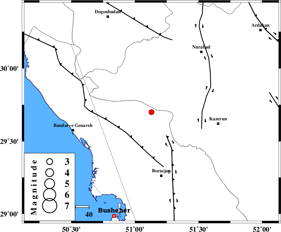
| Location | Lat:29.7 Lon: 51.13 |
| Region | Bushehr Province, 50 km North of Borazjan |
Nearest Cities |
|
| 25 km North West of Khesht, Fars Province | |
| 29 km North East of Dehkohneh, Bushehr Province | |
| 34 km North West of Dalki, Bushehr Province | |
| 34 km North West of Kamaraj, Fars Province | |
| 36 km North of Saedabad, Bushehr Province | |
| Depth | 16 km |
| Agency | |
Faults within 150 km: |
|
| BORAZJAN_F (Length: 168 km) , Distance to epicenter: 21 km | |
| ZFF3 (Length: 125 km) , Distance to epicenter: 25 km | |
| KAZERUN_F (Length: 96 km) , Distance to epicenter: 38 km | |
| Number of Phases | 5 |
| RMS | 0.1 |
| Number of Stations | 4 |
| Error in Latitude | >2.5 km |
| Error in Longitude | 2.8 km |
| Error in Depth | 5.7 km |
Download waveform in seisan format
to download seisan software Click here
to access information about IIEES stations Click here
Amplitude | ||||||||
| UID | Agency | Station | Component | Amplitude | Period | Arrival Time | Proccessing Time | Signal Clip |
| 86609 | IIEES | GHIR | E | 32.4 | 0.4 | 2012-10-15 20:05:01 | 2012-10-15 09:16:00 | n |
| 86610 | IIEES | SNGE | N | 2.5 | 0.56 | 2012-10-15 20:06:23 | 2012-10-15 09:16:00 | n |
| 86611 | IIEES | SNGE | E | 2.4 | 0.64 | 2012-10-15 20:06:29 | 2012-10-15 09:16:00 | n |
Phase | ||||||||||||
| Agency | Station | Component | Phase Type | Phase Quality | First Motion | Observed Arrival Time | Time Residual | Loc. Flag | Input Weight | Distance | Azimuth | |
| IIEES | AHRM | Z | Pg | E | 2012-10-15 20:03:55 | 0.07 | y | 94.2 | 170 | |||
| IIEES | AHRM | N | Sg | E | 2012-10-15 20:04:06 | -0.07 | y | 94.2 | 170 | |||
| IIEES | GHIR | Z | Pn | E | 2012-10-15 20:04:16 | 0.05 | y | 239 | 131 | |||
| IIEES | GHIR | E | Sg | E | 2012-10-15 20:04:46 | 0.01 | y | 239 | 131 | |||
| IIEES | YZKH | Z | Pn | E | 2012-10-15 20:04:41 | -0.07 | y | 445 | 47 | |||