
Magnitude |
:2.5 |
| Date & Time (UTC) | 2012-10-08 00:35:28.4 |
| Date & Time (Local) | 1391/7/17 04:05:28.4 |
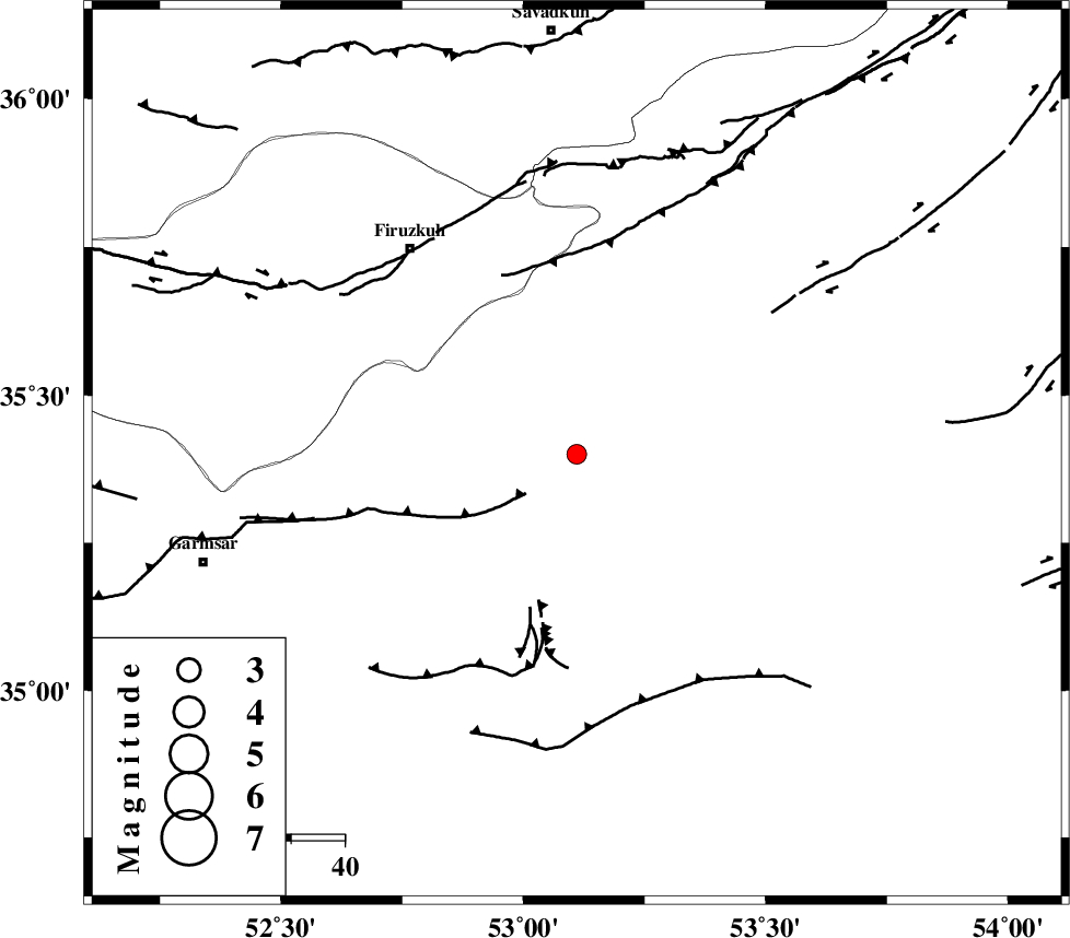
| Location | Lat:35.4 Lon: 53.11 |
| Region | Semnan Province, 32 km South-West of Semnan |
Nearest Cities |
|
| 2 km of Lasjerd, Semnan Province | |
| 11 km West of Sorkheh, Semnan Province | |
| 22 km South of Aftar, Semnan Province | |
| 32 km South West of Semnan, Semnan Province | |
| 38 km South West of Alae, Semnan Province | |
| Depth | 18 km |
| Agency | |
Faults within 150 km: |
|
| KUH_E_GACHAB_F2 (Length: 31 km) , Distance to epicenter: 17 km | |
| KUH_E_GACHAB_F1 (Length: 53 km) , Distance to epicenter: 26 km | |
| ATARI_F (Length: 185 km) , Distance to epicenter: 29 km | |
| Number of Phases | 6 |
| RMS | 0 |
| Number of Stations | 5 |
| Error in Latitude | >3.4 km |
| Error in Longitude | 1.9 km |
| Error in Depth | 5.5 km |
Download waveform in seisan format
to download seisan software Click here
to access information about IIEES stations Click here
Amplitude | ||||||||
| UID | Agency | Station | Component | Amplitude | Period | Arrival Time | Proccessing Time | Signal Clip |
| 86461 | IIEES | GHVR | N | 49.1 | 0.44 | 2012-10-08 00:36:36 | 2012-10-08 04:08:00 | n |
| 86462 | IIEES | GHVR | E | 60.4 | 0.4 | 2012-10-08 00:36:37 | 2012-10-08 04:08:00 | n |
| 86463 | IIEES | ASAO | E | 15.8 | 0.6 | 2012-10-08 00:36:55 | 2012-10-08 04:08:00 | n |
Phase | ||||||||||||
| Agency | Station | Component | Phase Type | Phase Quality | First Motion | Observed Arrival Time | Time Residual | Loc. Flag | Input Weight | Distance | Azimuth | |
| IIEES | CHTH | Z | Pn | E | 2012-10-08 00:35:59 | 0.05 | y | 188 | 288 | |||
| IIEES | GHVR | Z | Pn | E | 2012-10-08 00:36:00 | -0.07 | y | 199 | 240 | |||
| IIEES | GHVR | E | Sg | E | 2012-10-08 00:36:24 | 0.04 | y | 199 | 240 | |||
| IIEES | THKV | Z | Pn | E | 2012-10-08 00:36:01 | -0.04 | y | 210 | 286 | |||
| IIEES | SHRO | Z | Pn | E | 2012-10-08 00:36:09 | 0.03 | y | 271 | 75 | |||
| IIEES | ASAO | Z | Pn | E | 2012-10-08 00:36:12 | -0.01 | y | 297 | 252 | |||