
Magnitude |
:3.2 |
| Date & Time (UTC) | 2012-10-06 03:01:13.8 |
| Date & Time (Local) | 1391/7/15 06:31:13.8 |
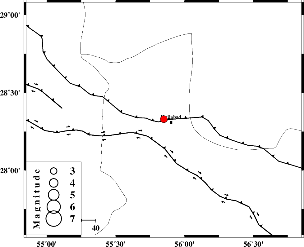
| Location | Lat:28.33 Lon: 55.85 |
| Region | Hormozgan Province, 6 km Hajiabad |
Nearest Cities |
|
| 6 km North of Hajiabad, Hormozgan Province | |
| 51 km North West of Fareqan, Hormozgan Province | |
| 51 km South West of Arzuieeh, Kerman Province | |
| 54 km South West of Shahmaran, Kerman Province | |
| 56 km South East of Tal bargah, Fars Province | |
| Depth | 6 km |
| Agency | |
Faults within 150 km: |
|
| MAIN_ZAGROS_R_F (Length: 1106 km) , Distance to epicenter: 2 km | |
| HZF2 (Length: 437 km) , Distance to epicenter: 17 km | |
| HZF1 (Length: 102 km) , Distance to epicenter: 73 km | |
| Number of Phases | 4 |
| RMS | 0 |
| Number of Stations | 4 |
| Error in Latitude | >3.2 km |
| Error in Longitude | 6.3 km |
| Error in Depth | 12.5 km |
Download waveform in seisan format
to download seisan software Click here
to access information about IIEES stations Click here
Amplitude | ||||||||
| UID | Agency | Station | Component | Amplitude | Period | Arrival Time | Proccessing Time | Signal Clip |
| 86416 | IIEES | BNDS | E | 811.8 | 0.32 | 2012-10-06 03:01:52 | 2012-10-06 03:44:00 | n |
| 86417 | IIEES | BNDS | N | 594.4 | 0.32 | 2012-10-06 03:01:55 | 2012-10-06 03:44:00 | n |
| 86418 | IIEES | KRBR | N | 266.9 | 0.56 | 2012-10-06 03:02:04 | 2012-10-06 03:44:00 | n |
| 86419 | IIEES | KRBR | E | 308.2 | 0.4 | 2012-10-06 03:02:09 | 2012-10-06 03:44:00 | n |
| 86420 | IIEES | GHIR | E | 62.4 | 0.56 | 2012-10-06 03:02:55 | 2012-10-06 03:44:00 | n |
Phase | ||||||||||||
| Agency | Station | Component | Phase Type | Phase Quality | First Motion | Observed Arrival Time | Time Residual | Loc. Flag | Input Weight | Distance | Azimuth | |
| IIEES | BNDS | Z | Pg | E | 2012-10-06 03:01:32 | -0.04 | y | 108 | 163 | |||
| IIEES | BNDS | E | Sg | E | 2012-10-06 03:01:46 | 0.03 | y | 108 | 163 | |||
| IIEES | GHIR | Z | Pn | E | 2012-10-06 03:01:57 | -0.01 | y | 281 | 270 | |||
| IIEES | YZKH | Z | Pn | E | 2012-10-06 03:02:20 | 0.02 | y | 466 | 345 | |||