
Magnitude |
:3.1 |
| Date & Time (UTC) | 2012-10-06 00:16:14.9 |
| Date & Time (Local) | 1391/7/15 03:46:14.9 |
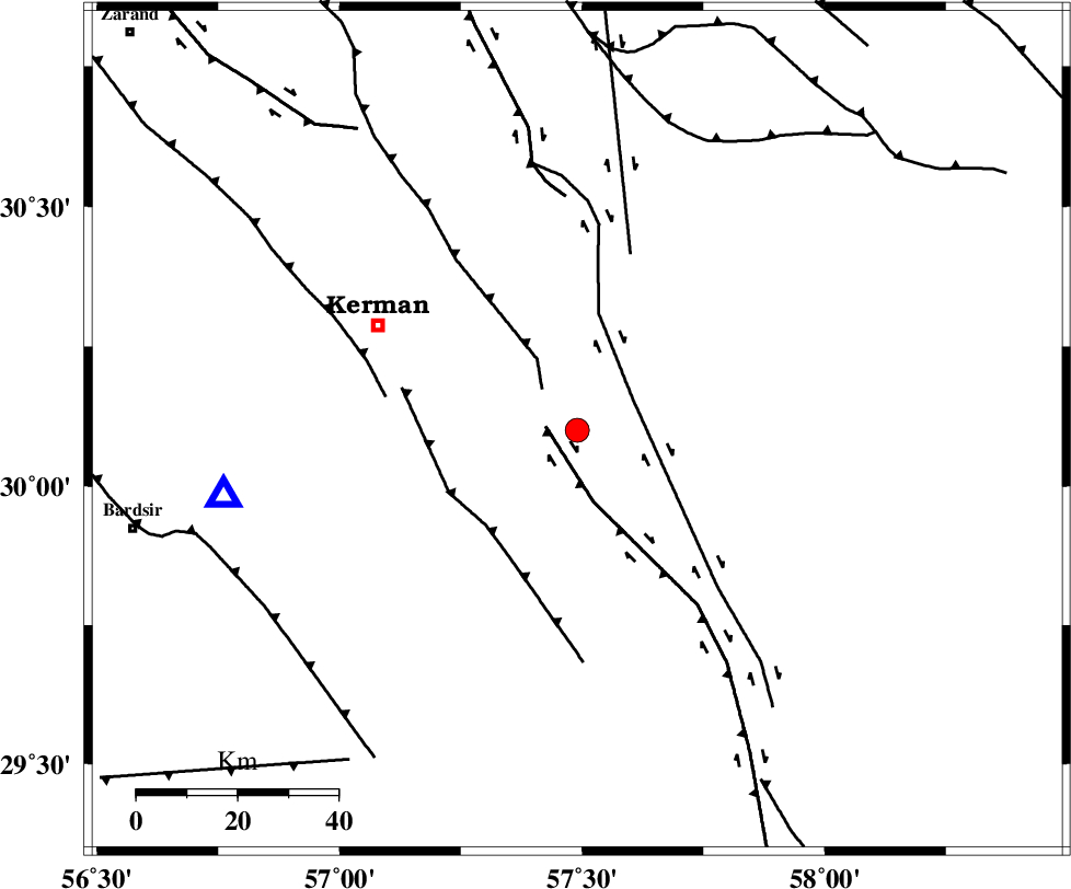
| Location | Lat:30.1 Lon: 57.49 |
| Region | Kerman Province, 45 km South-East of Kerman |
Nearest Cities |
|
| 13 km West of Jushan, Kerman Province | |
| 13 km of Sirch, Kerman Province | |
| 20 km North East of Mahan, Kerman Province | |
| 21 km North East of Langar, Kerman Province | |
| 25 km North East of Mohiabad, Kerman Province | |
| Depth | 15 km |
| Agency | |
Faults within 150 km: |
|
| GOWK_F (Length: 152 km) , Distance to epicenter: 6 km | |
| GOLBAF_SIRCH_F (Length: 114 km) , Distance to epicenter: 13 km | |
| NAYBAND_F (Length: 258 km) , Distance to epicenter: 37 km | |
| Number of Phases | 5 |
| RMS | 0.3 |
| Number of Stations | 6 |
| Error in Latitude | >3.2 km |
| Error in Longitude | 3 km |
| Error in Depth | 0 km |
Download waveform in seisan format
to download seisan software Click here
to access information about IIEES stations Click here
Amplitude | ||||||||
| UID | Agency | Station | Component | Amplitude | Period | Arrival Time | Proccessing Time | Signal Clip |
| 86414 | IIEES | KRBR | N | 836.9 | 0.28 | 2012-10-06 00:16:28 | 2012-10-06 12:47:00 | n |
| 86415 | IIEES | KRBR | E | 910.1 | 0.2 | 2012-10-06 00:16:32 | 2012-10-06 12:47:00 | n |
Phase | ||||||||||||
| Agency | Station | Component | Phase Type | Phase Quality | First Motion | Observed Arrival Time | Time Residual | Loc. Flag | Input Weight | Distance | Azimuth | |
| IIEES | ZHSF | Z | Pn | E | 2012-10-06 00:17:02 | 0.27 | y | 322 | 99 | |||
| IIEES | BNDS | Z | Pn | E | 2012-10-06 00:17:02 | -0.15 | y | 326 | 204 | |||
| IIEES | YZKH | Z | Pn | E | 2012-10-06 00:17:09 | 0.11 | y | 375 | 313 | |||
| IIEES | TABS | Z | Pn | E | 2012-10-06 00:17:11 | 0.23 | y | 395 | 355 | |||
| IIEES | SHRT | Z | Pn | E | 2012-10-06 00:17:20 | -0.56 | y | 474 | 33 | |||