
Magnitude |
:2.2 |
| Date & Time (UTC) | 2012-10-02 20:42:51.6 |
| Date & Time (Local) | 1391/7/12 00:12:51.6 |
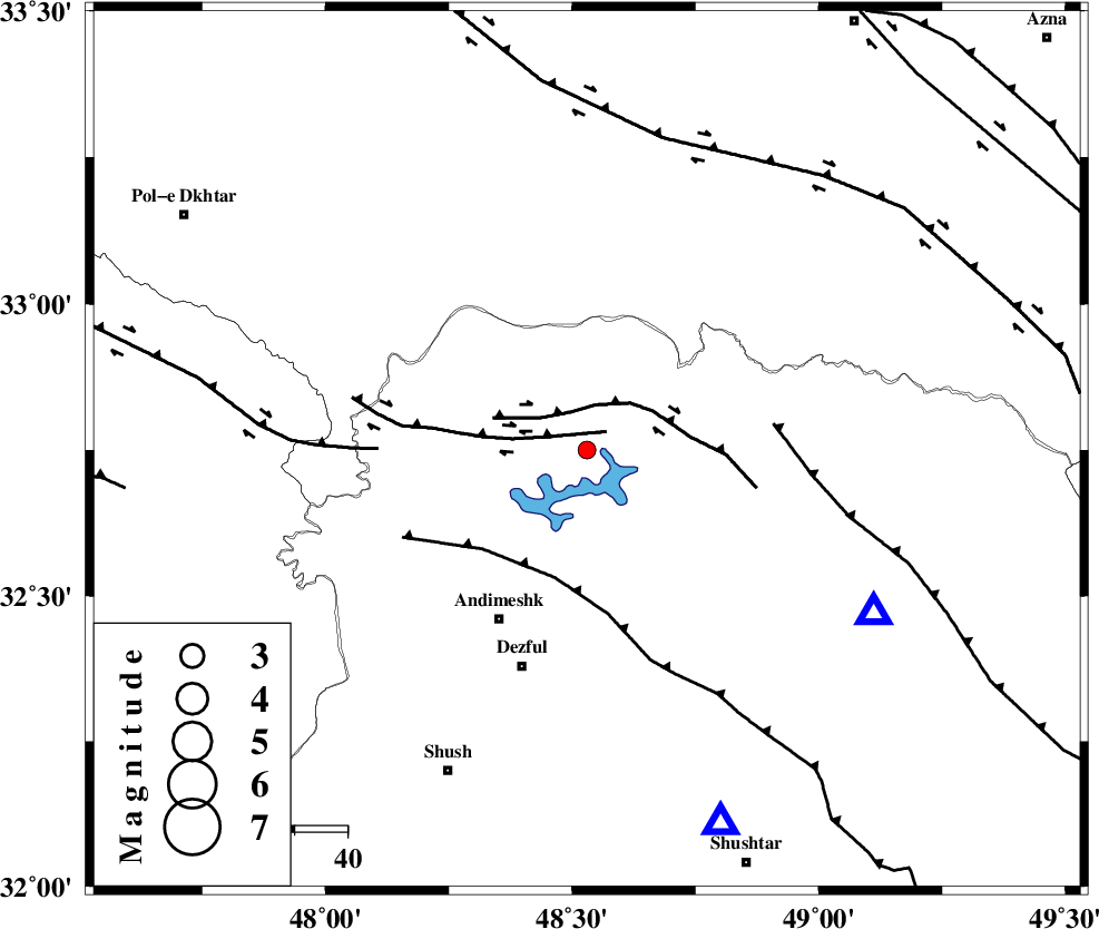
| Location | Lat:32.75 Lon: 48.53 |
| Region | Khoozestan Province, 36 km North-East of Andimeshk |
Nearest Cities |
|
| 19 km East of Sorkhakan, Khoozestan Province | |
| 27 km West of Shuy, Khoozestan Province | |
| 27 km East of Bidruyeh, Khoozestan Province | |
| 28 km North East of Hoseinieh, Khoozestan Province | |
| 36 km North East of Andimeshk, Khoozestan Province | |
| Depth | 15 km |
| Agency | |
Faults within 150 km: |
|
| BALARUD_F_Z3 (Length: 53 km) , Distance to epicenter: 5 km | |
| BALARUD_F_Z2 (Length: 58 km) , Distance to epicenter: 8 km | |
| DEZFUL_EMBAYMENT (Length: 228 km) , Distance to epicenter: 25 km | |
| Number of Phases | 3 |
| RMS | 0 |
| Number of Stations | 3 |
| Error in Latitude | >2 km |
| Error in Longitude | 9.6 km |
| Error in Depth | 0 km |
Download waveform in seisan format
to download seisan software Click here
to access information about IIEES stations Click here
Amplitude | ||||||||
| UID | Agency | Station | Component | Amplitude | Period | Arrival Time | Proccessing Time | Signal Clip |
| 86403 | IIEES | SHGR | E | 147.3 | 0.32 | 2012-10-02 20:43:17 | 2012-10-03 03:13:00 | n |
| 86404 | IIEES | SHGR | N | 110 | 0.28 | 2012-10-02 20:43:17 | 2012-10-03 03:13:00 | n |
| 86405 | IIEES | KHMZ | N | 23.4 | 0.64 | 2012-10-02 20:43:50 | 2012-10-03 03:13:00 | n |
Phase | ||||||||||||
| Agency | Station | Component | Phase Type | Phase Quality | First Motion | Observed Arrival Time | Time Residual | Loc. Flag | Input Weight | Distance | Azimuth | |
| IIEES | SHGR | Z | Pg | E | 2012-10-02 20:43:04 | 0 | y | 75.4 | 160 | |||
| IIEES | KHMZ | Z | Pg | E | 2012-10-02 20:43:20 | 0 | y | 173 | 50 | |||
| IIEES | ASAO | Z | Pn | E | 2012-10-02 20:43:29 | 0 | y | 243 | 34 | |||