
Magnitude |
:2.1 |
| Date & Time (UTC) | 2012-10-02 06:12:07.1 |
| Date & Time (Local) | 1391/7/11 09:42:07.1 |
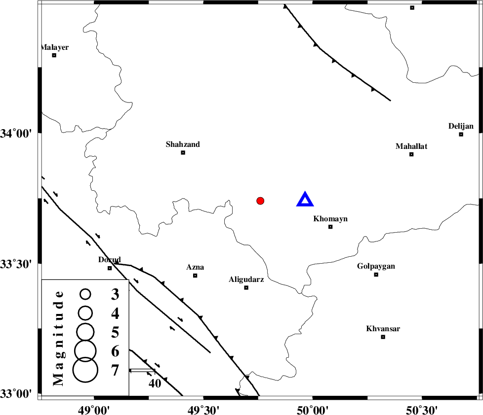
| Location | Lat:33.74 Lon: 49.76 |
| Region | Markazi Province, 37 km North of Aligudarz |
Nearest Cities |
|
| 11 km North of Qorchibashi, Markazi Province | |
| 15 km North of Javadiyeh, Markazi Province | |
| 19 km South of Qasemabad, Markazi Province | |
| 23 km South East of Hafteh, Markazi Province | |
| 31 km North of Khameh sofla, Lorestan Province | |
| Depth | 14 km |
| Agency | |
Faults within 150 km: |
|
| MAIN_ZAGROS_R_F (Length: 1106 km) , Distance to epicenter: 55 km | |
| DORUD (Length: 100 km) , Distance to epicenter: 65 km | |
| TAFRESH_F (Length: 117 km) , Distance to epicenter: 67 km | |
| Number of Phases | 5 |
| RMS | 0.1 |
| Number of Stations | 4 |
| Error in Latitude | >4.2 km |
| Error in Longitude | 9.6 km |
| Error in Depth | 8.9 km |
Download waveform in seisan format
to download seisan software Click here
to access information about IIEES stations Click here
Amplitude | ||||||||
| UID | Agency | Station | Component | Amplitude | Period | Arrival Time | Proccessing Time | Signal Clip |
| 86385 | IIEES | KHMZ | N | 397.2 | 0.37 | 2012-10-02 06:12:17 | 2012-10-02 06:47:00 | n |
| 86386 | IIEES | KHMZ | E | 306.6 | 0.44 | 2012-10-02 06:12:17 | 2012-10-02 06:47:00 | n |
| 86387 | IIEES | GHVR | E | 31.3 | 0.36 | 2012-10-02 06:13:00 | 2012-10-02 06:47:00 | n |
Phase | ||||||||||||
| Agency | Station | Component | Phase Type | Phase Quality | First Motion | Observed Arrival Time | Time Residual | Loc. Flag | Input Weight | Distance | Azimuth | |
| IIEES | KHMZ | Z | Pg | E | 2012-10-02 06:12:11 | -0.1 | y | 18.7 | 89 | |||
| IIEES | ASAO | Z | Pg | E | 2012-10-02 06:12:23 | -0.12 | y | 93.2 | 15 | |||
| IIEES | ASAO | E | Sg | E | 2012-10-02 06:12:34 | -0.08 | y | 93.2 | 15 | |||
| IIEES | GHVR | Z | Pg | E | 2012-10-02 06:12:33 | 0.04 | y | 160 | 58 | |||
| IIEES | CHTH | Z | Pg | E | 2012-10-02 06:12:51 | 0.27 | y | 271 | 27 | |||