
Magnitude |
:1.6 |
| Date & Time (UTC) | 2012-10-02 01:01:15.9 |
| Date & Time (Local) | 1391/7/11 04:31:15.9 |
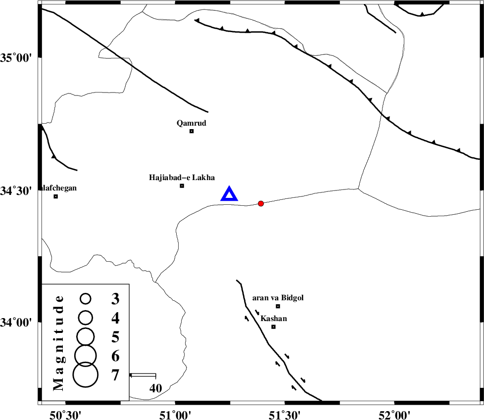
| Location | Lat:34.45 Lon: 51.39 |
| Region | Esfahan Province, 44 km North of Aran va bidgol |
Nearest Cities |
|
| 33 km North East of Mashgan, Esfahan Province | |
| 34 km East of Hajiabad-e lakha, Qom Province | |
| 36 km North of Nasrabad, Esfahan Province | |
| 42 km North East of Yahyaabad, Esfahan Province | |
| 42 km South East of Qamrud, Qom Province | |
| Depth | 6 km |
| Agency | |
Faults within 150 km: |
|
| KASHAN_F (Length: 44 km) , Distance to epicenter: 34 km | |
| KUSHK_E_NOSRAT_F (Length: 230 km) , Distance to epicenter: 44 km | |
| SIAHKUH_F (Length: 154 km) , Distance to epicenter: 63 km | |
| Number of Phases | 5 |
| RMS | 0.2 |
| Number of Stations | 4 |
| Error in Latitude | >4.8 km |
| Error in Longitude | 4.9 km |
| Error in Depth | 7.4 km |
Download waveform in seisan format
to download seisan software Click here
to access information about IIEES stations Click here
Amplitude | ||||||||
| UID | Agency | Station | Component | Amplitude | Period | Arrival Time | Proccessing Time | Signal Clip |
| 86384 | IIEES | KHMZ | E | 8.6 | 0.4 | 2012-10-02 01:02:08 | 2012-10-02 04:45:00 | n |
Phase | ||||||||||||
| Agency | Station | Component | Phase Type | Phase Quality | First Motion | Observed Arrival Time | Time Residual | Loc. Flag | Input Weight | Distance | Azimuth | |
| IIEES | GHVR | Z | Pg | E | 2012-10-02 01:01:18 | -0.39 | y | 13.4 | 285 | |||
| IIEES | ASAO | Z | Pg | E | 2012-10-02 01:01:37 | 0.11 | y | 126 | 275 | |||
| IIEES | ASAO | E | Sg | E | 2012-10-02 01:01:53 | 0.12 | y | 126 | 275 | |||
| IIEES | KHMZ | Z | Pg | E | 2012-10-02 01:01:42 | 0.04 | y | 153 | 239 | |||
| IIEES | CHTH | Z | Pn | E | 2012-10-02 01:01:45 | 0.12 | y | 164 | 352 | |||