
Magnitude |
:3.8 |
| Date & Time (UTC) | 2012-10-01 19:23:29.1 |
| Date & Time (Local) | 1391/7/10 22:53:29.1 |
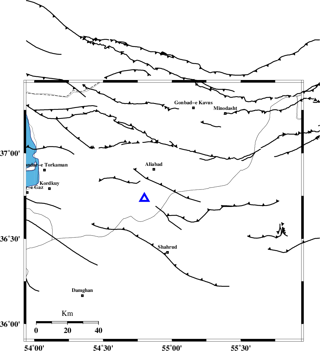
| Location | Lat:36.66 Lon: 54.94 |
| Region | Semnan Province, 27 km North of Shahrud |
Nearest Cities |
|
| 15 km North West of Qaleh-ye nokharqan, Semnan Province | |
| 21 km North of Bastam, Semnan Province | |
| 27 km North of Shahrud, Semnan Province | |
| 28 km South of Ali Abad, Golestan Province | |
| 33 km North East of Majen, Semnan Province | |
| Depth | 15 km |
| Agency | |
Faults within 150 km: |
|
| SHAVAR_F (Length: 87 km) , Distance to epicenter: 10 km | |
| ASTANEH_F (Length: 72 km) , Distance to epicenter: 36 km | |
| KHAZAR_F (Length: 523 km) , Distance to epicenter: 39 km | |
| Number of Phases | 10 |
| RMS | 0.5 |
| Number of Stations | 9 |
| Error in Latitude | >4.1 km |
| Error in Longitude | 5.8 km |
| Error in Depth | 8.7 km |
Download waveform in seisan format
to download seisan software Click here
to access information about IIEES stations Click here
Amplitude | ||||||||
| UID | Agency | Station | Component | Amplitude | Period | Arrival Time | Proccessing Time | Signal Clip |
| 86382 | IIEES | GHVR | E | 164.2 | 0.56 | 2012-10-01 19:25:46 | 2012-10-01 07:48:00 | n |
Phase | ||||||||||||
| Agency | Station | Component | Phase Type | Phase Quality | First Motion | Observed Arrival Time | Time Residual | Loc. Flag | Input Weight | Distance | Azimuth | |
| IIEES | SHRO | Z | Pg | E | 2012-10-01 19:23:49 | -0.37 | y | 121 | 127 | |||
| IIEES | MRVT | Z | Pg | E | 2012-10-01 19:23:53 | -0.42 | y | 151 | 42 | |||
| IIEES | MRVT | N | Sg | E | 2012-10-01 19:24:12 | 0.04 | y | 151 | 42 | |||
| IIEES | BJRD | N | Pn | E | 2012-10-01 19:24:08 | 0.47 | y | 248 | 62 | |||
| IIEES | CHTH | Z | Pn | E | 2012-10-01 19:24:21 | 0.81 | y | 353 | 257 | |||
| IIEES | TABS | Z | Pn | E | 2012-10-01 19:24:25 | 0.56 | y | 389 | 149 | |||
| IIEES | GHVR | Z | Pn | E | 2012-10-01 19:24:27 | -0.66 | y | 413 | 235 | |||
| IIEES | ASAO | Z | Pn | E | 2012-10-01 19:24:39 | -0.18 | y | 503 | 244 | |||
| IIEES | ZNJK | Z | Pn | E | 2012-10-01 19:24:46 | -0.35 | y | 559 | 272 | |||
| IIEES | SHRT | Z | Pn | E | 2012-10-01 19:24:50 | -0.07 | y | 591 | 123 | |||