
Magnitude |
:2.4 |
| Date & Time (UTC) | 2012-09-29 07:12:33.7 |
| Date & Time (Local) | 1391/7/8 10:42:33.7 |
| Location | Lat:34.93 Lon: 49.84 |
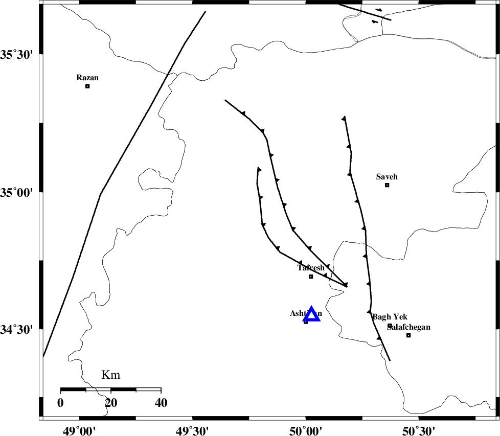
| Region | Markazi Province, 32 km North-West of Tafresh |
Nearest Cities |
|
| 14 km North of Jaghtan, Markazi Province | |
| 18 km North of Bazarjan, Markazi Province | |
| 20 km South of Gharqabad, Markazi Province | |
| 22 km North West of Khanak, Markazi Province | |
| 23 km South West of Qeytaniyeh, Markazi Province | |
| Depth | 14 km |
| Agency | |
Faults within 150 km: |
|
| INDES_F (Length: 98 km) , Distance to epicenter: 16 km | |
| TAFRESH_F (Length: 117 km) , Distance to epicenter: 28 km | |
| KUSHK_E_NOSRAT_F (Length: 230 km) , Distance to epicenter: 36 km | |
| Number of Phases | 8 |
| RMS | 0.2 |
| Number of Stations | 6 |
| Error in Latitude | >1.9 km |
| Error in Longitude | 4 km |
| Error in Depth | 9.9 km |
Download waveform in seisan format
to download seisan software Click here
to access information about IIEES stations Click here
Amplitude | ||||||||
| UID | Agency | Station | Component | Amplitude | Period | Arrival Time | Proccessing Time | Signal Clip |
| 86336 | IIEES | GHVR | E | 72.9 | 0.28 | 2012-09-29 07:13:16 | 2012-09-29 09:02:00 | n |
Phase | ||||||||||||
| Agency | Station | Component | Phase Type | Phase Quality | First Motion | Observed Arrival Time | Time Residual | Loc. Flag | Input Weight | Distance | Azimuth | |
| IIEES | ASAO | Z | Pg | E | 2012-09-29 07:12:42 | 0.15 | y | 45.9 | 158 | |||
| IIEES | KHMZ | Z | Pg | E | 2012-09-29 07:12:56 | 0.17 | y | 133 | 175 | |||
| IIEES | KHMZ | N | Sg | E | 2012-09-29 07:13:11 | -0.29 | y | 133 | 175 | |||
| IIEES | GHVR | Z | Pg | E | 2012-09-29 07:12:56 | -0.18 | y | 138 | 111 | |||
| IIEES | GHVR | N | Sg | E | 2012-09-29 07:13:13 | 0.27 | y | 138 | 111 | |||
| IIEES | THKV | Z | Pg | E | 2012-09-29 07:12:57 | 0.03 | y | 144 | 41 | |||
| IIEES | CHTH | Z | Pg | E | 2012-09-29 07:12:59 | -0.34 | y | 159 | 47 | |||
| IIEES | ZNJK | Z | Pn | E | 2012-09-29 07:13:08 | 0.18 | y | 219 | 332 | |||