
Magnitude |
:2.9 |
| Date & Time (UTC) | 2012-09-11 12:35:13.1 |
| Date & Time (Local) | 1391/6/21 17:05:13.1 |
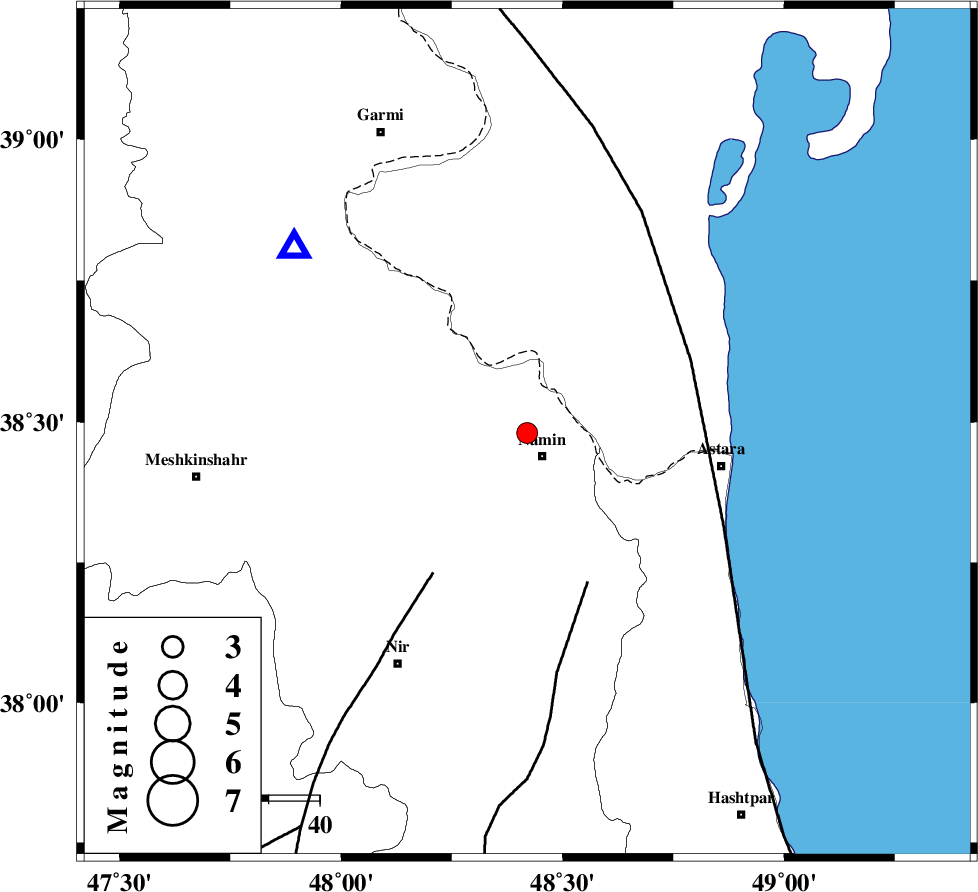
| Location | Lat:38.48 Lon: 48.42 |
| Region | Ardebil Province, 5 km Namin |
Nearest Cities |
|
| 2 km North of Khaneh zeinian, Ardebil Province | |
| 4 km of Anbaran, Ardebil Province | |
| 5 km North of Namin, Ardebil Province | |
| 12 km of Lurun, Ardebil Province | |
| 12 km North East of Taqi dizaj, Ardebil Province | |
| Depth | 15 km |
| Agency | |
Faults within 150 km: |
|
| SANGAVAR_F (Length: 61 km) , Distance to epicenter: 32 km | |
| BOZQUSH (Length: 70 km) , Distance to epicenter: 33 km | |
| TALESH_F (Length: 258 km) , Distance to epicenter: 35 km | |
| Number of Phases | 5 |
| RMS | 0.1 |
| Number of Stations | 3 |
| Error in Latitude | >3.7 km |
| Error in Longitude | 4.4 km |
| Error in Depth | 6 km |
Download waveform in seisan format
to download seisan software Click here
to access information about IIEES stations Click here
Amplitude | ||||||||
| UID | Agency | Station | Component | Amplitude | Period | Arrival Time | Proccessing Time | Signal Clip |
| 86087 | IIEES | GRMI | E | 871.9 | 0.6 | 2012-09-11 12:35:32 | 2012-09-11 12:53:00 | n |
| 86088 | IIEES | GRMI | N | 839.4 | 0.24 | 2012-09-11 12:35:32 | 2012-09-11 12:53:00 | n |
Phase | ||||||||||||
| Agency | Station | Component | Phase Type | Phase Quality | First Motion | Observed Arrival Time | Time Residual | Loc. Flag | Input Weight | Distance | Azimuth | |
| IIEES | GRMI | Z | Pg | E | 2012-09-11 12:35:23 | -0.1 | y | 58.8 | 309 | |||
| IIEES | GRMI | E | Sg | E | 2012-09-11 12:35:31 | 0.12 | y | 58.8 | 309 | |||
| IIEES | ZNJK | Z | Pn | E | 2012-09-11 12:35:46 | 0.05 | y | 202 | 173 | |||
| IIEES | MAKU | Z | Pn | E | 2012-09-11 12:36:02 | -0.05 | y | 339 | 288 | |||
| IIEES | MAKU | E | Sg | E | 2012-09-11 12:36:48 | -0.03 | y | 339 | 288 | |||