
Magnitude |
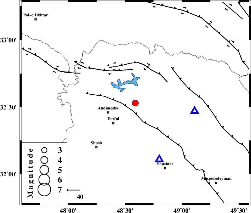
:3.5 |
| Date & Time (UTC) | 2012-09-07 16:06:45.4 |
| Date & Time (Local) | 1391/6/17 20:36:45.4 |
| Location | Lat:32.53 Lon: 48.59 |
| Region | Khoozestan Province, 24 km East of Andimeshk |
Nearest Cities |
|
| 17 km North of Mahur berenji, Khoozestan Province | |
| 23 km North West of Sardasht, Khoozestan Province | |
| 24 km North East of Andimeshk, Khoozestan Province | |
| 25 km North East of Dezful, Khoozestan Province | |
| 30 km North East of Shamsabad, Khoozestan Province | |
| Depth | 14 km |
| Agency | |
Faults within 150 km: |
|
| DEZFUL_EMBAYMENT (Length: 228 km) , Distance to epicenter: 7 km | |
| BALARUD_F_Z3 (Length: 53 km) , Distance to epicenter: 28 km | |
| BALARUD_F_Z2 (Length: 58 km) , Distance to epicenter: 30 km | |
| Number of Phases | 5 |
| RMS | 0.1 |
| Number of Stations | 4 |
| Error in Latitude | >1.6 km |
| Error in Longitude | 4.7 km |
| Error in Depth | 4.9 km |
Download waveform in seisan format
to download seisan software Click here
to access information about IIEES stations Click here
Amplitude | ||||||||
| UID | Agency | Station | Component | Amplitude | Period | Arrival Time | Proccessing Time | Signal Clip |
| 86009 | IIEES | SHGR | E | 12830.5 | 0.88 | 2012-09-07 16:07:14 | 2012-09-07 04:25:00 | n |
| 86010 | IIEES | SHGR | N | 7566 | 0.52 | 2012-09-07 16:07:14 | 2012-09-07 04:25:00 | n |
| 86011 | IIEES | SNGE | E | 70.3 | 0.56 | 2012-09-07 16:08:17 | 2012-09-07 04:25:00 | n |
| 86012 | IIEES | GHVR | N | 56.7 | 0.64 | 2012-09-07 16:08:33 | 2012-09-07 04:25:00 | n |
Phase | ||||||||||||
| Agency | Station | Component | Phase Type | Phase Quality | First Motion | Observed Arrival Time | Time Residual | Loc. Flag | Input Weight | Distance | Azimuth | |
| IIEES | SHGR | Z | Pg | E | 2012-09-07 16:06:54 | -0.08 | y | 50.5 | 157 | |||
| IIEES | ASAO | Z | Pn | E | 2012-09-07 16:07:25 | 0.1 | y | 261 | 30 | |||
| IIEES | ASAO | E | Sg | E | 2012-09-07 16:07:59 | -0.12 | y | 261 | 30 | |||
| IIEES | SNGE | Z | Pn | E | 2012-09-07 16:07:31 | -0.05 | y | 307 | 338 | |||
| IIEES | GHVR | Z | Pn | E | 2012-09-07 16:07:34 | 0.16 | y | 328 | 48 | |||