
Magnitude |
:4.1 |
| Date & Time (UTC) | 2012-09-06 13:40:59.3 |
| Date & Time (Local) | 1391/6/16 18:10:59.3 |
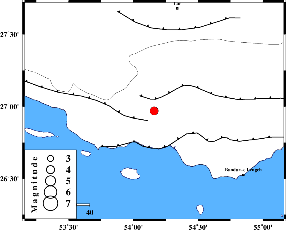
| Location | Lat:26.97 Lon: 54.16 |
| Region | Hormozgan Province, 32 km South-West of Bastak |
Nearest Cities |
|
| 13 km West of Jenah, Hormozgan Province | |
| 32 km South West of Bastak, Hormozgan Province | |
| 48 km South East of Ahl, Fars Province | |
| 60 km South East of Bagh, Fars Province | |
| 61 km South East of Ashkenan, Fars Province | |
| Depth | 18 km |
| Agency | |
Faults within 150 km: |
|
| MFF3 (Length: 292 km) , Distance to epicenter: 9 km | |
| MFF1 (Length: 180 km) , Distance to epicenter: 9 km | |
| ZFF1 (Length: 165 km) , Distance to epicenter: 28 km | |
| Number of Phases | 5 |
| RMS | 0.1 |
| Number of Stations | 4 |
| Error in Latitude | >9.5 km |
| Error in Longitude | 3.6 km |
| Error in Depth | 6.2 km |
Download waveform in seisan format
to download seisan software Click here
to access information about IIEES stations Click here
Amplitude | ||||||||
| UID | Agency | Station | Component | Amplitude | Period | Arrival Time | Proccessing Time | Signal Clip |
| 85987 | IIEES | GHIR | E | 2679.7 | 0.52 | 2012-09-06 13:42:03 | 2012-09-06 02:14:00 | n |
| 85988 | IIEES | BNDS | E | 1205.2 | 0.44 | 2012-09-06 13:42:14 | 2012-09-06 02:14:00 | n |
Phase | ||||||||||||
| Agency | Station | Component | Phase Type | Phase Quality | First Motion | Observed Arrival Time | Time Residual | Loc. Flag | Input Weight | Distance | Azimuth | |
| IIEES | GHIR | Z | Pn | E | 2012-09-06 13:41:29 | 0.03 | y | 186 | 322 | |||
| IIEES | GHIR | E | Sg | E | 2012-09-06 13:41:52 | 0.01 | y | 186 | 322 | |||
| IIEES | BNDS | N | Sg | E | 2012-09-06 13:41:57 | 0 | y | 205 | 76 | |||
| IIEES | YZKH | Z | Pn | E | 2012-09-06 13:42:21 | 0.07 | y | 602 | 4 | |||
| IIEES | NASN | Z | Pn | E | 2012-09-06 13:42:28 | -0.15 | y | 659 | 349 | |||