
Magnitude |
:3.4 |
| Date & Time (UTC) | 2012-09-06 04:26:54.8 |
| Date & Time (Local) | 1391/6/16 08:56:54.8 |
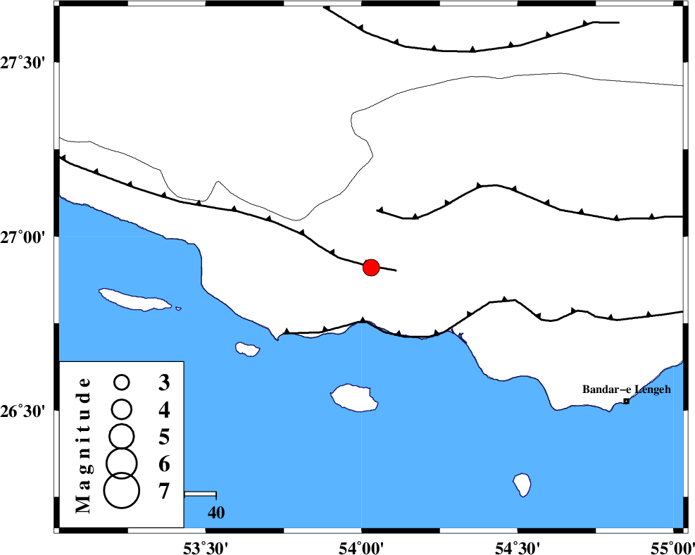
| Location | Lat:26.91 Lon: 54.03 |
| Region | Hormozgan Province, 46 km South-West of Bastak |
Nearest Cities |
|
| 28 km South West of Jenah, Hormozgan Province | |
| 41 km South East of Ahl, Fars Province | |
| 46 km South West of Bastak, Hormozgan Province | |
| 54 km South East of Ashkenan, Fars Province | |
| 65 km South of Bagh, Fars Province | |
| Depth | 14 km |
| Agency | |
Faults within 150 km: |
|
| MFF3 (Length: 292 km) , Distance to epicenter: 3 km | |
| ZFF1 (Length: 165 km) , Distance to epicenter: 17 km | |
| MFF1 (Length: 180 km) , Distance to epicenter: 18 km | |
| Number of Phases | 5 |
| RMS | 0 |
| Number of Stations | 4 |
| Error in Latitude | >6.4 km |
| Error in Longitude | 6.9 km |
| Error in Depth | 8.6 km |
Download waveform in seisan format
to download seisan software Click here
to access information about IIEES stations Click here
Amplitude | ||||||||
| UID | Agency | Station | Component | Amplitude | Period | Arrival Time | Proccessing Time | Signal Clip |
| 85984 | IIEES | GHIR | E | 426.6 | 0.36 | 2012-09-06 04:27:54 | 2012-09-06 05:04:00 | n |
Phase | ||||||||||||
| Agency | Station | Component | Phase Type | Phase Quality | First Motion | Observed Arrival Time | Time Residual | Loc. Flag | Input Weight | Distance | Azimuth | |
| IIEES | GHIR | Z | Pg | E | 2012-09-06 04:27:25 | -0.01 | y | 184 | 326 | |||
| IIEES | GHIR | E | Sg | E | 2012-09-06 04:27:47 | 0 | y | 184 | 326 | |||
| IIEES | KRBR | Z | P | E | 2012-09-06 04:27:56 | 0 | y | 433 | 38 | |||
| IIEES | ASAO | Z | Pn | E | 2012-09-06 04:28:58 | 0.05 | y | 929 | 337 | |||
| IIEES | SHRT | Z | P | E | 2012-09-06 04:29:01 | 0 | y | 959 | 37 | |||