
Magnitude |
:3.8 |
| Date & Time (UTC) | 2012-09-03 08:40:36.1 |
| Date & Time (Local) | 1391/6/13 13:10:36.1 |
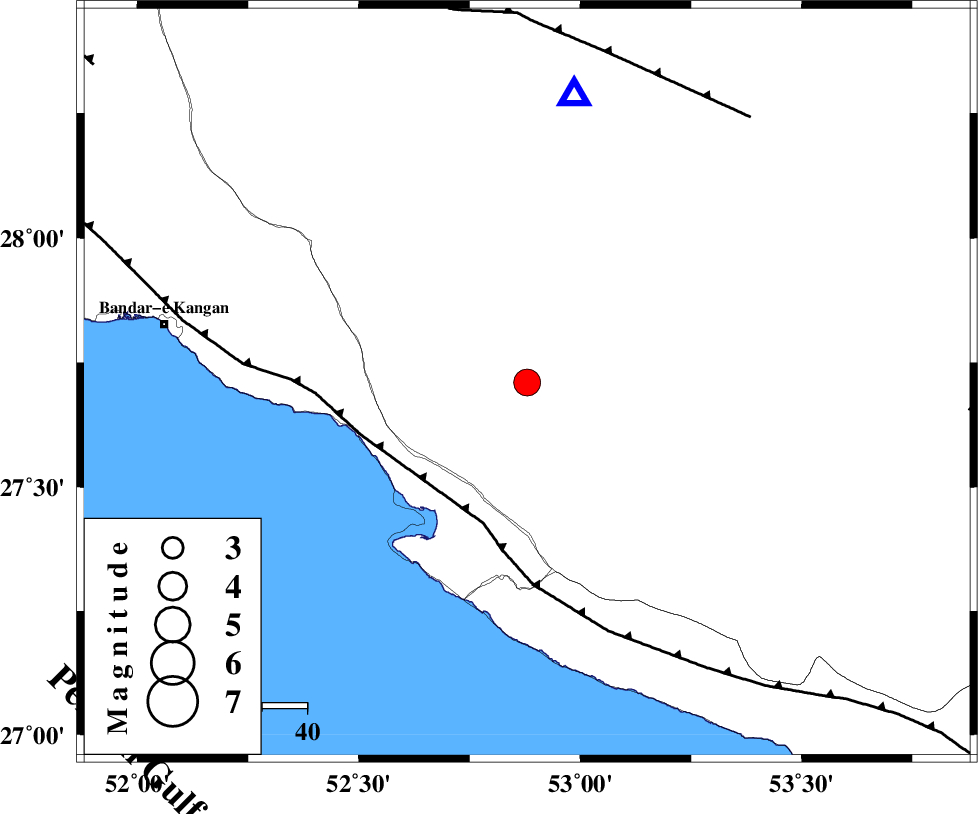
| Location | Lat:27.71 Lon: 52.88 |
| Region | Fars Province, 18 km North of Mehr |
Nearest Cities |
|
| 13 km North of Alamarvdasht, Fars Province | |
| 16 km North of Ardavan-e olia, Fars Province | |
| 18 km North of Mehr, Fars Province | |
| 21 km East of Asir, Fars Province | |
| 22 km North East of Gallehdar, Fars Province | |
| Depth | 15 km |
| Agency | |
Faults within 150 km: |
|
| MFF3 (Length: 292 km) , Distance to epicenter: 33 km | |
| QIR_F (Length: 130 km) , Distance to epicenter: 76 km | |
| LAR_F (Length: 99 km) , Distance to epicenter: 98 km | |
| Number of Phases | 6 |
| RMS | 0.2 |
| Number of Stations | 7 |
| Error in Latitude | >7.5 km |
| Error in Longitude | 2.2 km |
| Error in Depth | 0 km |
Download waveform in seisan format
to download seisan software Click here
to access information about IIEES stations Click here
Amplitude | ||||||||
| UID | Agency | Station | Component | Amplitude | Period | Arrival Time | Proccessing Time | Signal Clip |
| 85939 | IIEES | GHIR | E | 5053.2 | 0.45 | 2012-09-03 08:40:59 | 2012-09-03 09:35:00 | n |
Phase | ||||||||||||
| Agency | Station | Component | Phase Type | Phase Quality | First Motion | Observed Arrival Time | Time Residual | Loc. Flag | Input Weight | Distance | Azimuth | |
| IIEES | BNDS | Z | Pn | E | 2012-09-03 08:41:24 | -0.02 | y | 326 | 95 | |||
| IIEES | YZKH | Z | Pn | E | 2012-09-03 08:41:51 | 0.33 | y | 545 | 17 | |||
| IIEES | NASN | Z | Pn | E | 2012-09-03 08:41:53 | -0.39 | y | 565 | 359 | |||
| IIEES | KHMZ | Z | Pn | E | 2012-09-03 08:42:13 | 0.01 | y | 725 | 338 | |||
| IIEES | TABS | Z | Pn | E | 2012-09-03 08:42:19 | -0.07 | y | 774 | 31 | |||
| IIEES | SNGE | Z | Pn | E | 2012-09-03 08:42:45 | 0.31 | y | 973 | 329 | |||