
Magnitude |
:2.9 |
| Date & Time (UTC) | 2012-09-02 12:33:46.5 |
| Date & Time (Local) | 1391/6/12 17:03:46.5 |
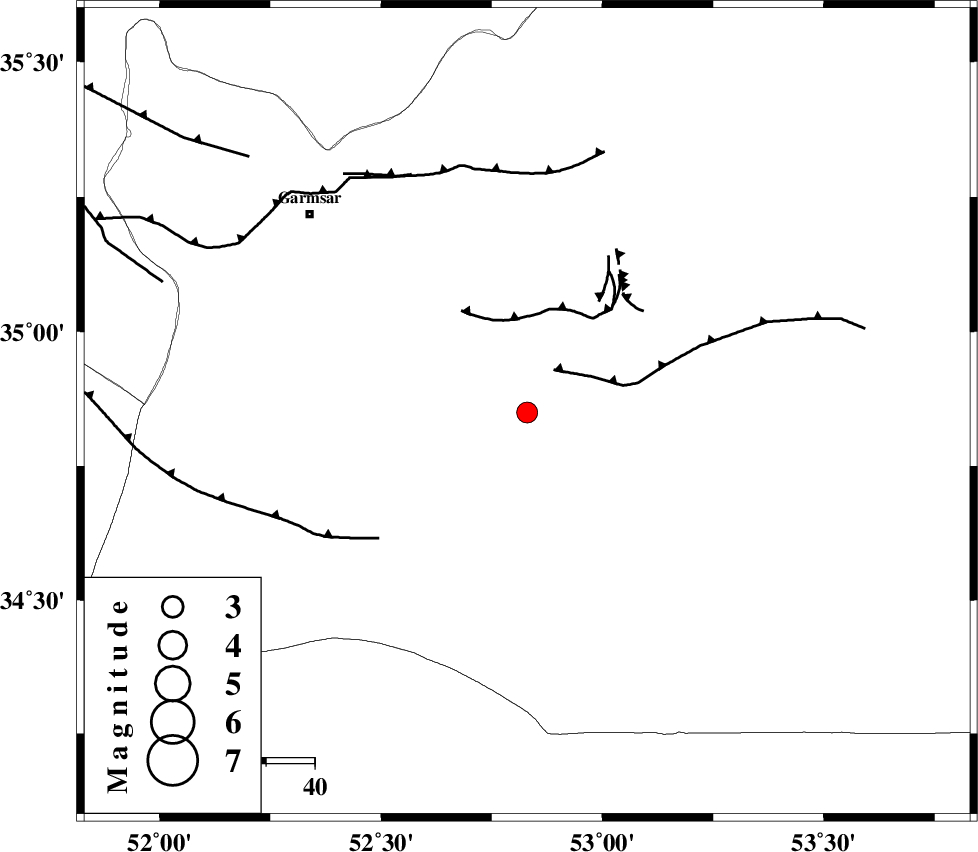
| Location | Lat:34.85 Lon: 52.83 |
| Region | Semnan Province, 61 km South-East of Garmsar |
Nearest Cities |
|
| 49 km South East of Kohanabad, Semnan Province | |
| 52 km South East of Gardovan, Semnan Province | |
| 52 km South East of Aradan, Semnan Province | |
| 52 km South East of Davarabad, Semnan Province | |
| 60 km South East of Lajran, Semnan Province | |
| Depth | 33 km |
| Agency | |
Faults within 150 km: |
|
| KUH_E_GUGERD_F (Length: 73 km) , Distance to epicenter: 10 km | |
| KUH_E_GACHAB_F1 (Length: 53 km) , Distance to epicenter: 21 km | |
| SIAHKUH_F (Length: 154 km) , Distance to epicenter: 38 km | |
| Number of Phases | 6 |
| RMS | 0.1 |
| Number of Stations | 5 |
| Error in Latitude | >2.8 km |
| Error in Longitude | 2.8 km |
| Error in Depth | 4.8 km |
Download waveform in seisan format
to download seisan software Click here
to access information about IIEES stations Click here
Amplitude | ||||||||
| UID | Agency | Station | Component | Amplitude | Period | Arrival Time | Proccessing Time | Signal Clip |
| 85924 | IIEES | CHTH | E | 127.6 | 0.52 | 2012-09-02 12:34:41 | 2012-09-02 01:05:00 | n |
Phase | ||||||||||||
| Agency | Station | Component | Phase Type | Phase Quality | First Motion | Observed Arrival Time | Time Residual | Loc. Flag | Input Weight | Distance | Azimuth | |
| IIEES | GHVR | Z | Pg | E | 2012-09-02 12:34:11 | -0.16 | y | 151 | 255 | |||
| IIEES | GHVR | E | Sg | E | 2012-09-02 12:34:29 | 0.14 | y | 151 | 255 | |||
| IIEES | CHTH | Z | Pn | E | 2012-09-02 12:34:16 | 0.12 | y | 194 | 308 | |||
| IIEES | NASN | Z | Pn | E | 2012-09-02 12:34:21 | 0.07 | y | 227 | 180 | |||
| IIEES | ASAO | Z | Pn | E | 2012-09-02 12:34:24 | -0.19 | y | 259 | 263 | |||
| IIEES | SHRO | Z | Pn | E | 2012-09-02 12:34:31 | 0.01 | y | 316 | 65 | |||