
Magnitude |
:2.6 |
| Date & Time (UTC) | 2012-08-27 15:40:16.3 |
| Date & Time (Local) | 1391/6/6 20:10:16.3 |
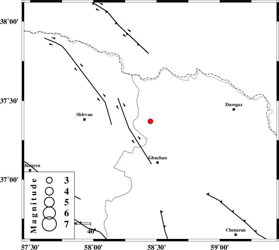
| Location | Lat:37.37 Lon: 58.45 |
| Region | Khorasan(center) Province, 29 km North of Quchan |
Nearest Cities |
|
| 7 km of Emamqoli, Khorasan(center) Province | |
| 18 km North East of Yatnakanlu, Khorasan(center) Province | |
| 26 km North of Mazraj, Khorasan(center) Province | |
| 27 km North East of Faruj, Khorasan(center) Province | |
| 27 km North of Shahr-e kohneh, Khorasan(center) Province | |
| Depth | 14 km |
| Agency | |
Faults within 150 km: |
|
| GHUCHAN_F (Length: 50 km) , Distance to epicenter: 16 km | |
| BAGHAN_GERMAB_F (Length: 79 km) , Distance to epicenter: 27 km | |
| MAIN_KOPEHDAGH_F3 (Length: 96 km) , Distance to epicenter: 48 km | |
| Number of Phases | 4 |
| RMS | 0 |
| Number of Stations | 3 |
| Error in Latitude | >5.4 km |
| Error in Longitude | 4.9 km |
| Error in Depth | 6.6 km |
Download waveform in seisan format
to download seisan software Click here
to access information about IIEES stations Click here
Amplitude | ||||||||
| UID | Agency | Station | Component | Amplitude | Period | Arrival Time | Proccessing Time | Signal Clip |
| 85831 | IIEES | MRVT | E | 49.6 | 0.28 | 2012-08-27 15:41:20 | 2012-08-28 01:44:00 | n |
| 85832 | IIEES | MRVT | N | 41.6 | 0.56 | 2012-08-27 15:41:23 | 2012-08-28 01:44:00 | n |
Phase | ||||||||||||
| Agency | Station | Component | Phase Type | Phase Quality | First Motion | Observed Arrival Time | Time Residual | Loc. Flag | Input Weight | Distance | Azimuth | |
| IIEES | BJRD | Z | Pg | E | 2012-08-27 15:40:33 | -0.04 | y | 99.6 | 292 | |||
| IIEES | MRVT | Z | Pn | E | 2012-08-27 15:40:50 | 0.06 | y | 212 | 280 | |||
| IIEES | MRVT | N | Sg | E | 2012-08-27 15:41:16 | 0 | y | 212 | 280 | |||
| IIEES | SHRO | Z | Pn | E | 2012-08-27 15:40:56 | -0.02 | y | 265 | 236 | |||