
Magnitude |
:2.8 |
| Date & Time (UTC) | 2012-08-23 02:18:01.5 |
| Date & Time (Local) | 1391/6/2 06:48:01.5 |
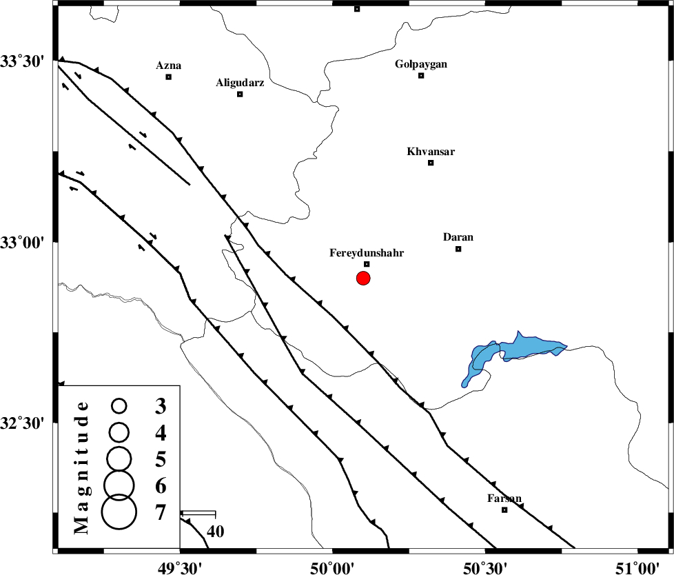
| Location | Lat:32.9 Lon: 50.1 |
| Region | Esfahan Province, 5 km Fereydunshahr |
Nearest Cities |
|
| 4 km North of Sibak, Esfahan Province | |
| 4 km of Fereydunshahr, Esfahan Province | |
| 12 km of Sangbaran, Esfahan Province | |
| 14 km South of Afus, Esfahan Province | |
| 21 km South of Buien-va-miandasht, Esfahan Province | |
| Depth | 18 km |
| Agency | |
Faults within 150 km: |
|
| MAIN_ZAGROS_R_F (Length: 1106 km) , Distance to epicenter: 15 km | |
| ARDAL_F (Length: 170 km) , Distance to epicenter: 31 km | |
| ZARDKUH_F (Length: 139 km) , Distance to epicenter: 44 km | |
| Number of Phases | 7 |
| RMS | 0.1 |
| Number of Stations | 5 |
| Error in Latitude | >1.3 km |
| Error in Longitude | 2.9 km |
| Error in Depth | 4.2 km |
Download waveform in seisan format
to download seisan software Click here
to access information about IIEES stations Click here
Amplitude | ||||||||
| UID | Agency | Station | Component | Amplitude | Period | Arrival Time | Proccessing Time | Signal Clip |
| 85702 | IIEES | SHGR | N | 216.9 | 0.4 | 2012-08-23 02:18:46 | 2012-08-23 02:54:00 | n |
| 85703 | IIEES | SHGR | E | 134.5 | 0.4 | 2012-08-23 02:18:46 | 2012-08-23 02:54:00 | n |
Phase | ||||||||||||
| Agency | Station | Component | Phase Type | Phase Quality | First Motion | Observed Arrival Time | Time Residual | Loc. Flag | Input Weight | Distance | Azimuth | |
| IIEES | KHMZ | Z | Pg | E | 2012-08-23 02:18:17 | -0.13 | y | 94.4 | 353 | |||
| IIEES | KHMZ | E | Sg | E | 2012-08-23 02:18:29 | 0.11 | y | 94.4 | 353 | |||
| IIEES | SHGR | Z | Pg | E | 2012-08-23 02:18:26 | -0.03 | y | 150 | 235 | |||
| IIEES | SHGR | N | Sg | E | 2012-08-23 02:18:44 | 0.05 | y | 150 | 235 | |||
| IIEES | ASAO | Z | Pn | E | 2012-08-23 02:18:31 | -0.12 | y | 183 | 358 | |||
| IIEES | GHVR | Z | Pn | E | 2012-08-23 02:18:34 | 0.07 | y | 206 | 31 | |||
| IIEES | NASN | Z | Pn | E | 2012-08-23 02:18:40 | 0.05 | y | 254 | 92 | |||