
Magnitude |
:2.4 |
| Date & Time (UTC) | 2012-08-22 17:28:14.5 |
| Date & Time (Local) | 1391/6/1 21:58:14.5 |
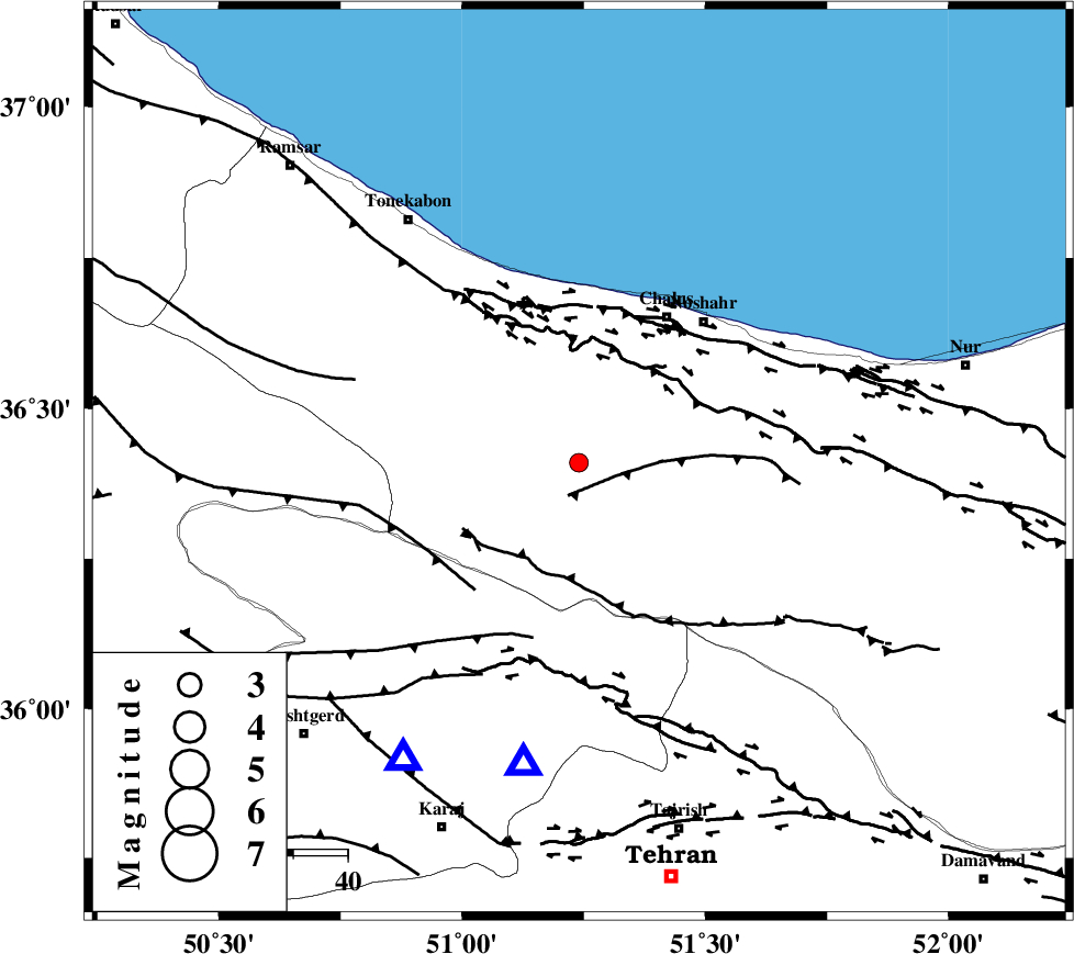
| Location | Lat:36.41 Lon: 51.24 |
| Region | Mazandaran Province, 32 km South-West of Chalus |
Nearest Cities |
|
| 3 km North of Tavir, Mazandaran Province | |
| 4 km of Marzanabad, Mazandaran Province | |
| 9 km of Goyter, Mazandaran Province | |
| 13 km South of Kardichal, Mazandaran Province | |
| 23 km North of Pol-e zanguleh, Mazandaran Province | |
| Depth | 6 km |
| Agency | |
Faults within 150 km: |
|
| KOJOOR (Length: 75 km) , Distance to epicenter: 6 km | |
| KANDOVAN_F (Length: 90 km) , Distance to epicenter: 20 km | |
| N_ALBORZ_F (Length: 360 km) , Distance to epicenter: 21 km | |
| Number of Phases | 6 |
| RMS | 0.1 |
| Number of Stations | 4 |
| Error in Latitude | >2.2 km |
| Error in Longitude | 2.9 km |
| Error in Depth | 3.5 km |
Download waveform in seisan format
to download seisan software Click here
to access information about IIEES stations Click here
Amplitude | ||||||||
| UID | Agency | Station | Component | Amplitude | Period | Arrival Time | Proccessing Time | Signal Clip |
| 85692 | IIEES | THKV | N | 220 | 0.4 | 2012-08-22 17:28:35 | 2012-08-22 07:41:00 | n |
Phase | ||||||||||||
| Agency | Station | Component | Phase Type | Phase Quality | First Motion | Observed Arrival Time | Time Residual | Loc. Flag | Input Weight | Distance | Azimuth | |
| IIEES | CHTH | Z | Pg | E | 2012-08-22 17:28:24 | -0.02 | y | 56.2 | 191 | |||
| IIEES | CHTH | E | Sg | E | 2012-08-22 17:28:32 | 0.11 | y | 56.2 | 191 | |||
| IIEES | THKV | Z | Pg | E | 2012-08-22 17:28:25 | -0.06 | y | 63.5 | 211 | |||
| IIEES | DAMV | Z | Pg | E | 2012-08-22 17:28:33 | 0 | y | 108 | 142 | |||
| IIEES | GHVR | Z | Pn | E | 2012-08-22 17:28:49 | 0.06 | y | 214 | 180 | |||
| IIEES | GHVR | E | Sg | E | 2012-08-22 17:29:17 | -0.09 | y | 214 | 180 | |||