
Magnitude |
:4 |
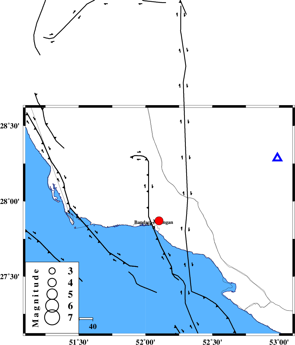
| Date & Time (UTC) | 2012-08-18 19:17:31.6 |
| Date & Time (Local) | 1391/5/28 23:47:31.6 |
| Location | Lat:27.87 Lon: 52.1 |
| Region | Bushehr Province, 6 km Bandar-e kangan |
Nearest Cities |
|
| 6 km North of Bandar-e kangan, Bushehr Province | |
| 20 km South of Riz, Bushehr Province | |
| 22 km North West of Jam, Bushehr Province | |
| 33 km North West of Bandar-e taheri, Bushehr Province | |
| 36 km South West of Dolatabad, Fars Province | |
| Depth | 37 km |
| Agency | |
Faults within 150 km: |
|
| MFF3 (Length: 292 km) , Distance to epicenter: 4 km | |
| MFF5 (Length: 74 km) , Distance to epicenter: 57 km | |
| BORAZJAN_F (Length: 168 km) , Distance to epicenter: 57 km | |
| Number of Phases | 4 |
| RMS | 0 |
| Number of Stations | 4 |
| Error in Latitude | >11.7 km |
| Error in Longitude | 10 km |
| Error in Depth | 9.9 km |
Download waveform in seisan format
to download seisan software Click here
to access information about IIEES stations Click here
Amplitude | ||||||||
| UID | Agency | Station | Component | Amplitude | Period | Arrival Time | Proccessing Time | Signal Clip |
| 85588 | IIEES | GHIR | E | 4936.9 | 0.4 | 2012-08-18 19:18:15 | 2012-08-19 08:41:00 | n |
| 85589 | IIEES | KRBR | N | 102.6 | 0.48 | 2012-08-18 19:19:34 | 2012-08-19 08:41:00 | n |
| 85590 | IIEES | KRBR | E | 119.4 | 0.44 | 2012-08-18 19:19:36 | 2012-08-19 08:41:00 | n |
Phase | ||||||||||||
| Agency | Station | Component | Phase Type | Phase Quality | First Motion | Observed Arrival Time | Time Residual | Loc. Flag | Input Weight | Distance | Azimuth | |
| IIEES | GHIR | Z | Pg | E | 2012-08-18 19:17:48 | 0 | y | 98.9 | 62 | |||
| IIEES | GHIR | E | Sg | E | 2012-08-18 19:18:01 | 0 | y | 98.9 | 62 | |||
| IIEES | NASN | Z | Pn | E | 2012-08-18 19:18:45 | 0 | y | 551 | 7 | |||
| IIEES | TABS | Z | Pn | E | 2012-08-18 19:19:16 | -0.01 | y | 801 | 36 | |||