
Magnitude |
:2.6 |
| Date & Time (UTC) | 2012-08-16 22:00:51.4 |
| Date & Time (Local) | 1391/5/27 02:30:51.4 |
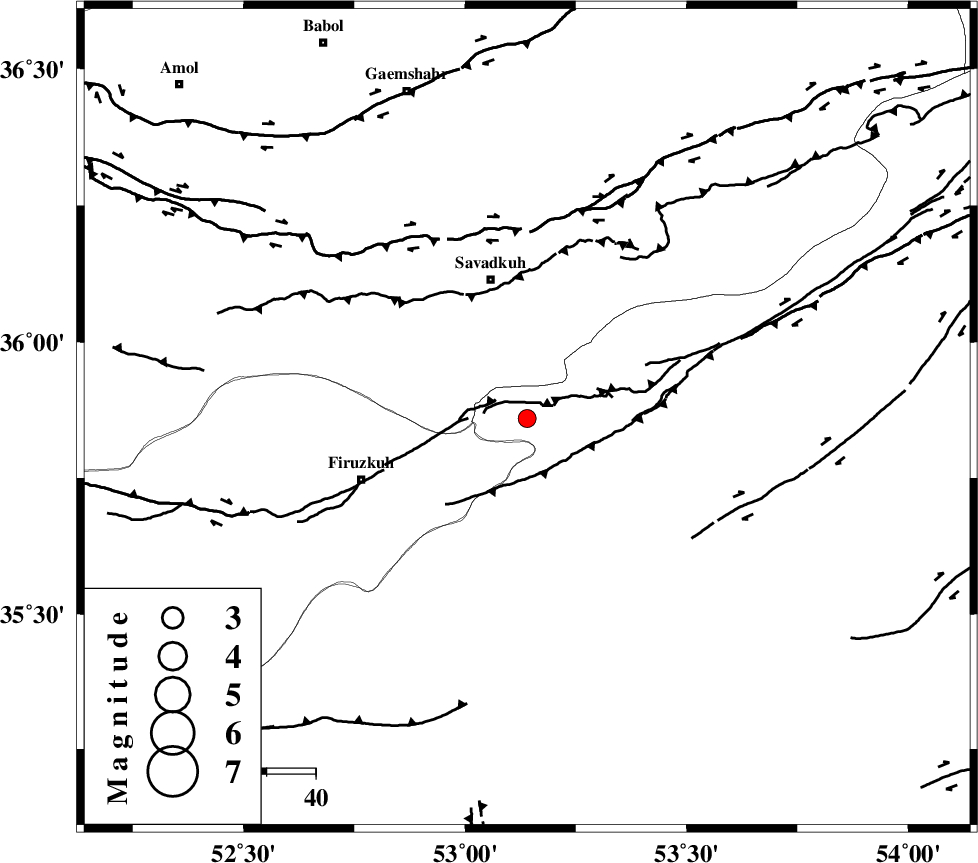
| Location | Lat:35.86 Lon: 53.14 |
| Region | Semnan Province, 30 km South of Pol-E-Sefid |
Nearest Cities |
|
| 12 km West of Chashem, Semnan Province | |
| 20 km North West of Shahmirzad, Semnan Province | |
| 24 km South of Sangdeh, Mazandaran Province | |
| 25 km North West of Mehdishahr, Semnan Province | |
| 27 km South of Shurmast-e peyrudbar, Mazandaran Province | |
| Depth | 18 km |
| Agency | |
Faults within 150 km: |
|
| ATARI_F (Length: 185 km) , Distance to epicenter: 19 km | |
| N_ALBORZ_F (Length: 360 km) , Distance to epicenter: 38 km | |
| MOSHA_F (Length: 234 km) , Distance to epicenter: 49 km | |
| Number of Phases | 5 |
| RMS | 0.1 |
| Number of Stations | 3 |
| Error in Latitude | >2.9 km |
| Error in Longitude | 2.8 km |
| Error in Depth | 6.2 km |
Download waveform in seisan format
to download seisan software Click here
to access information about IIEES stations Click here
Amplitude | ||||||||
| UID | Agency | Station | Component | Amplitude | Period | Arrival Time | Proccessing Time | Signal Clip |
| 85468 | IIEES | THKV | N | 64.3 | 0.4 | 2012-08-16 22:01:56 | 2012-08-16 10:40:00 | n |
| 85469 | IIEES | GHVR | N | 39 | 0.64 | 2012-08-16 22:02:05 | 2012-08-16 10:40:00 | n |
| 85470 | IIEES | GHVR | E | 43.3 | 0.44 | 2012-08-16 22:02:08 | 2012-08-16 10:40:00 | n |
Phase | ||||||||||||
| Agency | Station | Component | Phase Type | Phase Quality | First Motion | Observed Arrival Time | Time Residual | Loc. Flag | Input Weight | Distance | Azimuth | |
| IIEES | THKV | Z | Pn | E | 2012-08-16 22:01:24 | 0.1 | y | 204 | 273 | |||
| IIEES | THKV | N | Sg | E | 2012-08-16 22:01:49 | -0.05 | y | 204 | 273 | |||
| IIEES | GHVR | Z | Pn | E | 2012-08-16 22:01:27 | -0.23 | y | 230 | 229 | |||
| IIEES | GHVR | E | Sg | E | 2012-08-16 22:01:56 | 0.1 | y | 230 | 229 | |||
| IIEES | SHRO | Z | Pn | E | 2012-08-16 22:01:31 | 0.08 | y | 260 | 85 | |||