
Magnitude |
:3 |
| Date & Time (UTC) | 2012-08-08 08:37:20.3 |
| Date & Time (Local) | 1391/5/18 13:07:20.3 |
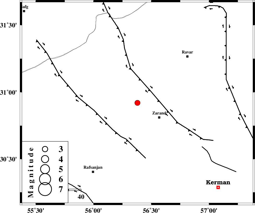
| Location | Lat:30.92 Lon: 56.38 |
| Region | Kerman Province, 21 km North-West of Zarand |
Nearest Cities |
|
| 22 km North West of Zarand, Kerman Province | |
| 22 km North West of Mohammadabad, Kerman Province | |
| 23 km South West of Dasht-e khak, Kerman Province | |
| 26 km West of Ahmadi, Kerman Province | |
| 26 km South of Toghroljerd, Kerman Province | |
| Depth | 6 km |
| Agency | |
Faults within 150 km: |
|
| KUHBANAN_F (Length: 189 km) , Distance to epicenter: 15 km | |
| DARIVAN_F (Length: 131 km) , Distance to epicenter: 30 km | |
| CHATRUD_F (Length: 37 km) , Distance to epicenter: 64 km | |
| Number of Phases | 5 |
| RMS | 0.1 |
| Number of Stations | 4 |
| Error in Latitude | >2.6 km |
| Error in Longitude | 4.9 km |
| Error in Depth | 9.3 km |
Download waveform in seisan format
to download seisan software Click here
to access information about IIEES stations Click here
Amplitude | ||||||||
| UID | Agency | Station | Component | Amplitude | Period | Arrival Time | Proccessing Time | Signal Clip |
| 84837 | IIEES | KRBR | N | 192.3 | 0.76 | 2012-08-08 08:37:55 | 2012-08-08 09:17:00 | n |
| 84838 | IIEES | GHIR | N | 45.1 | 0.31 | 2012-08-08 08:39:04 | 2012-08-08 09:17:00 | n |
Phase | ||||||||||||
| Agency | Station | Component | Phase Type | Phase Quality | First Motion | Observed Arrival Time | Time Residual | Loc. Flag | Input Weight | Distance | Azimuth | |
| IIEES | KRBR | Z | Pg | E | 2012-08-08 08:37:39 | -0.02 | y | 110 | 161 | |||
| IIEES | KRBR | N | Sg | E | 2012-08-08 08:37:53 | -0.03 | y | 110 | 161 | |||
| IIEES | YZKH | Z | Pn | E | 2012-08-08 08:37:58 | -0.14 | y | 235 | 314 | |||
| IIEES | TABS | Z | Pn | E | 2012-08-08 08:38:07 | 0.09 | y | 310 | 13 | |||
| IIEES | GHIR | Z | Pn | E | 2012-08-08 08:38:23 | 0.14 | y | 440 | 229 | |||