
Magnitude |
:3 |
| Date & Time (UTC) | 2012-07-31 18:30:27.1 |
| Date & Time (Local) | 1391/5/10 23:00:27.1 |
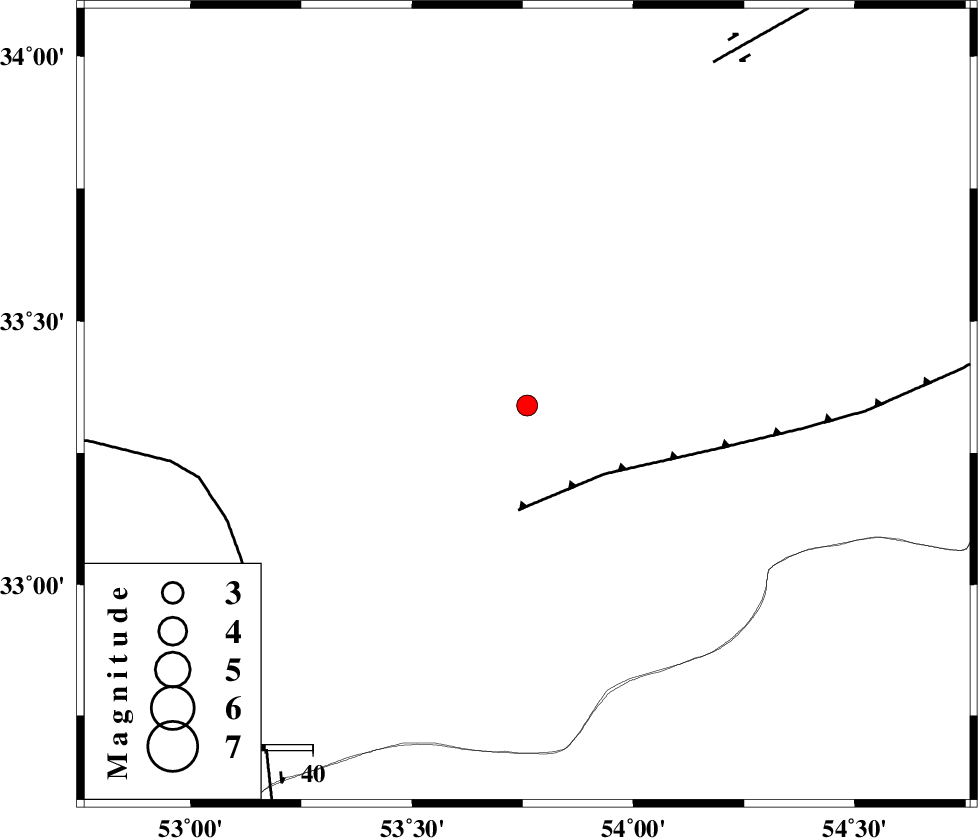
| Location | Lat:33.34 Lon: 53.76 |
| Region | Esfahan Province, 81 km North-East of Nain |
Nearest Cities |
|
| 6 km North of Anarak, Esfahan Province | |
| 51 km South East of Maedan, Esfahan Province | |
| 65 km South West of Chupanan, Esfahan Province | |
| 81 km North East of Baferan, Esfahan Province | |
| 82 km North East of Nain, Esfahan Province | |
| Depth | 18 km |
| Agency | |
Faults within 150 km: |
|
| BIABANAK_F (Length: 162 km) , Distance to epicenter: 22 km | |
| CHAH_ZANGUL_F (Length: 123 km) , Distance to epicenter: 68 km | |
| DORUNEH_F (Length: 713 km) , Distance to epicenter: 82 km | |
| Number of Phases | 6 |
| RMS | 0.1 |
| Number of Stations | 6 |
| Error in Latitude | >2.9 km |
| Error in Longitude | 2.5 km |
| Error in Depth | 5.2 km |
Download waveform in seisan format
to download seisan software Click here
to access information about IIEES stations Click here
Amplitude | ||||||||
| UID | Agency | Station | Component | Amplitude | Period | Arrival Time | Proccessing Time | Signal Clip |
| 84691 | IIEES | GHVR | N | 58.2 | 0.4 | 2012-07-31 18:31:44 | 2012-07-31 06:53:00 | n |
| 84692 | IIEES | THKV | E | 35.9 | 0.48 | 2012-07-31 18:32:28 | 2012-07-31 06:53:00 | n |
| 84693 | IIEES | THKV | N | 32.3 | 0.4 | 2012-07-31 18:32:30 | 2012-07-31 06:53:00 | n |
Phase | ||||||||||||
| Agency | Station | Component | Phase Type | Phase Quality | First Motion | Observed Arrival Time | Time Residual | Loc. Flag | Input Weight | Distance | Azimuth | |
| IIEES | NASN | Z | Pg | E | 2012-07-31 18:30:45 | -0.18 | y | 107 | 236 | |||
| IIEES | YZKH | Z | Pg | E | 2012-07-31 18:30:49 | 0.15 | y | 131 | 143 | |||
| IIEES | GHVR | Z | Pn | E | 2012-07-31 18:31:07 | 0.05 | y | 264 | 299 | |||
| IIEES | GHVR | N | Sg | E | 2012-07-31 18:31:41 | 0.09 | y | 264 | 299 | |||
| IIEES | SHRO | Z | Pn | E | 2012-07-31 18:31:19 | -0.17 | y | 361 | 34 | |||
| IIEES | CHTH | Z | Pn | E | 2012-07-31 18:31:21 | 0.04 | y | 373 | 320 | |||