
Magnitude |
:2.3 |
| Date & Time (UTC) | 2012-07-29 17:01:58.3 |
| Date & Time (Local) | 1391/5/8 21:31:58.3 |
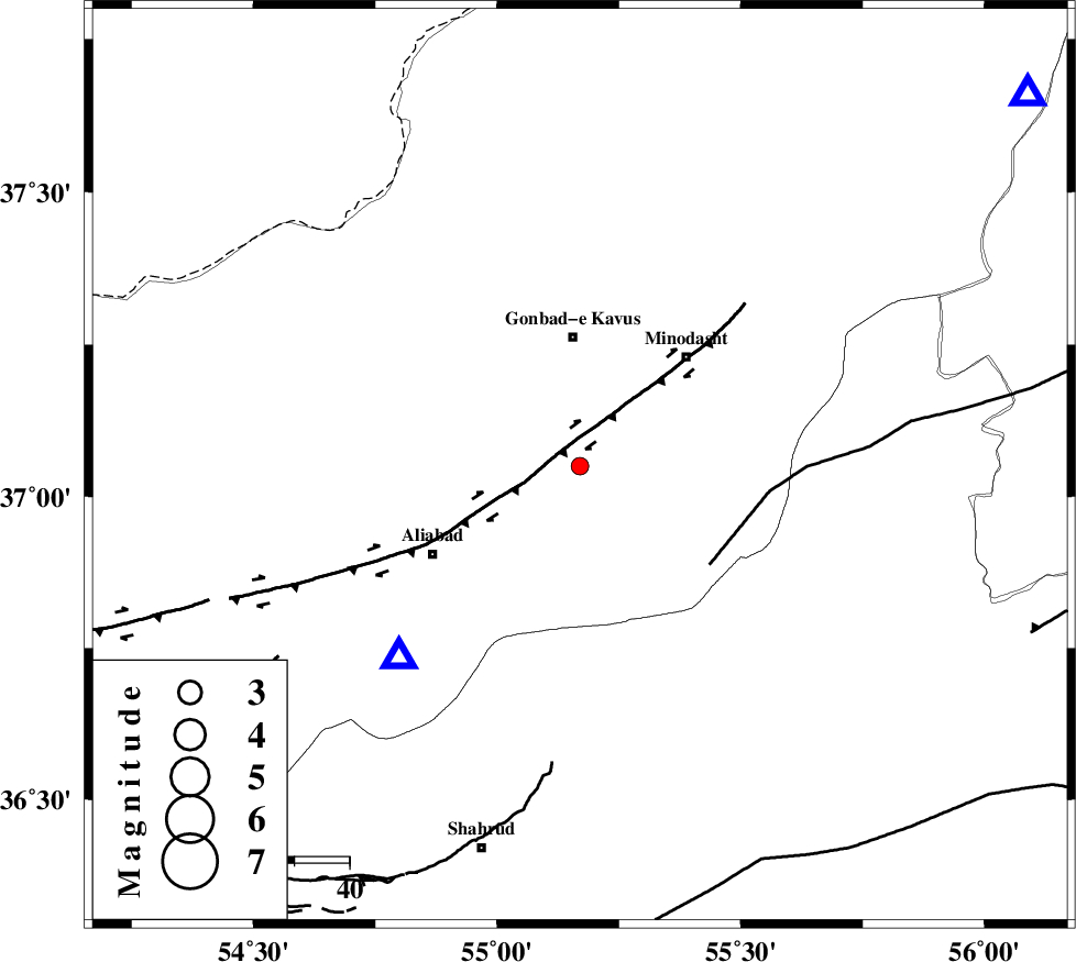
| Location | Lat:37.05 Lon: 55.17 |
| Region | Golestan Province, 5 km Azadshahr |
Nearest Cities |
|
| 4 km of Khanduz, Golestan Province | |
| 4 km of Azadshahr, Golestan Province | |
| 5 km North of Ramian, Golestan Province | |
| 10 km of Nezamabad, Golestan Province | |
| 10 km North East of Deland, Golestan Province | |
| Depth | 14 km |
| Agency | |
Faults within 150 km: |
|
| KHAZAR_F (Length: 523 km) , Distance to epicenter: 19 km | |
| ROBATE_QARABIL_F (Length: 168 km) , Distance to epicenter: 30 km | |
| SHAVAR_F (Length: 87 km) , Distance to epicenter: 31 km | |
| Number of Phases | 5 |
| RMS | 0.1 |
| Number of Stations | 3 |
| Error in Latitude | >2.8 km |
| Error in Longitude | 6.1 km |
| Error in Depth | 5.8 km |
Download waveform in seisan format
to download seisan software Click here
to access information about IIEES stations Click here
Amplitude | ||||||||
| UID | Agency | Station | Component | Amplitude | Period | Arrival Time | Proccessing Time | Signal Clip |
| 84690 | IIEES | MRVT | N | 89.1 | 0.41 | 2012-07-29 17:02:34 | 2012-07-31 08:28:00 | n |
Phase | ||||||||||||
| Agency | Station | Component | Phase Type | Phase Quality | First Motion | Observed Arrival Time | Time Residual | Loc. Flag | Input Weight | Distance | Azimuth | |
| IIEES | MRVT | Z | Pg | E | 2012-07-29 17:02:16 | -0.1 | y | 106 | 50 | |||
| IIEES | MRVT | E | Sg | E | 2012-07-29 17:02:29 | -0.12 | y | 106 | 50 | |||
| IIEES | SHRO | Z | Pg | E | 2012-07-29 17:02:21 | -0.1 | y | 138 | 146 | |||
| IIEES | BJRD | Z | Pn | E | 2012-07-29 17:02:32 | 0.26 | y | 212 | 69 | |||
| IIEES | BJRD | E | Sg | E | 2012-07-29 17:02:58 | 0.06 | y | 212 | 69 | |||