
Magnitude |
:3.1 |
| Date & Time (UTC) | 2012-07-31 07:11:13.0 |
| Date & Time (Local) | 1391/5/10 11:41:13.0 |
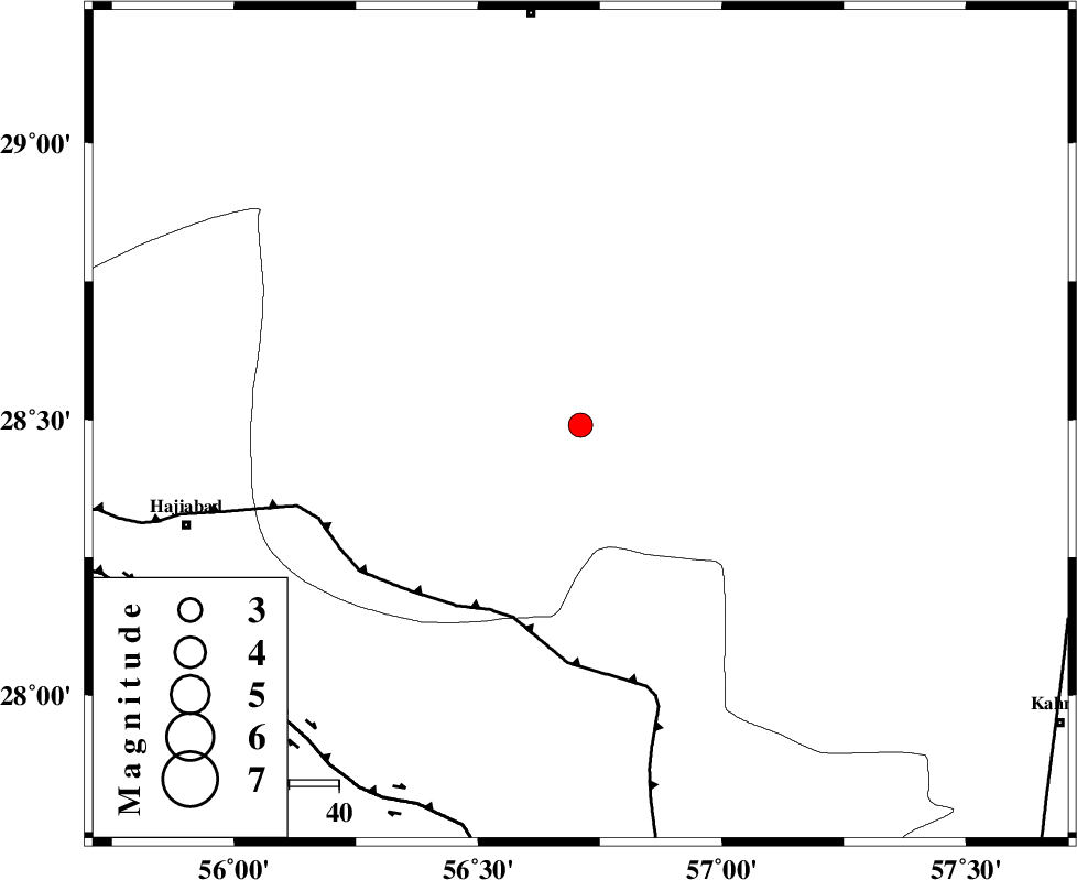
| Location | Lat:28.49 Lon: 56.71 |
| Region | Kerman Province, 84 km South-East of Baft |
Nearest Cities |
|
| 23 km North West of Sarkhan, Kerman Province | |
| 32 km North East of Shahmaran, Kerman Province | |
| 35 km North East of Arzuieeh, Kerman Province | |
| 44 km South West of Dolatabad, Kerman Province | |
| 53 km South of Kashkueyeh, Kerman Province | |
| Depth | 14 km |
| Agency | |
Faults within 150 km: |
|
| MAIN_ZAGROS_R_F (Length: 1106 km) , Distance to epicenter: 41 km | |
| HZF2 (Length: 437 km) , Distance to epicenter: 83 km | |
| ZENDAN_MINAB_F_Z1 (Length: 183 km) , Distance to epicenter: 96 km | |
| Number of Phases | 6 |
| RMS | 0.2 |
| Number of Stations | 5 |
| Error in Latitude | >2.2 km |
| Error in Longitude | 4.9 km |
| Error in Depth | 5.9 km |
Download waveform in seisan format
to download seisan software Click here
to access information about IIEES stations Click here
Amplitude | ||||||||
| UID | Agency | Station | Component | Amplitude | Period | Arrival Time | Proccessing Time | Signal Clip |
| 84688 | IIEES | BNDS | N | 329.5 | 0.39 | 2012-07-31 07:12:01 | 2012-07-31 08:28:00 | n |
| 84689 | IIEES | KRBR | E | 246.6 | 0.42 | 2012-07-31 07:12:02 | 2012-07-31 08:28:00 | n |
Phase | ||||||||||||
| Agency | Station | Component | Phase Type | Phase Quality | First Motion | Observed Arrival Time | Time Residual | Loc. Flag | Input Weight | Distance | Azimuth | |
| IIEES | BNDS | Z | Pg | E | 2012-07-31 07:11:34 | -0.29 | y | 132 | 204 | |||
| IIEES | KRBR | Z | Pg | E | 2012-07-31 07:11:40 | -0.02 | y | 166 | 2 | |||
| IIEES | KRBR | N | Sg | E | 2012-07-31 07:12:00 | -0.09 | y | 166 | 2 | |||
| IIEES | GHIR | Z | P | E | 2012-07-31 07:12:06 | 0.4 | y | 366 | 267 | |||
| IIEES | ZHSF | Z | Pn | E | 2012-07-31 07:12:12 | 0.25 | y | 415 | 72 | |||
| IIEES | TABS | Z | Pn | E | 2012-07-31 07:12:31 | -0.23 | y | 574 | 4 | |||