
Magnitude |
:2.4 |
| Date & Time (UTC) | 2012-07-28 19:12:50.0 |
| Date & Time (Local) | 1391/5/7 23:42:50.0 |
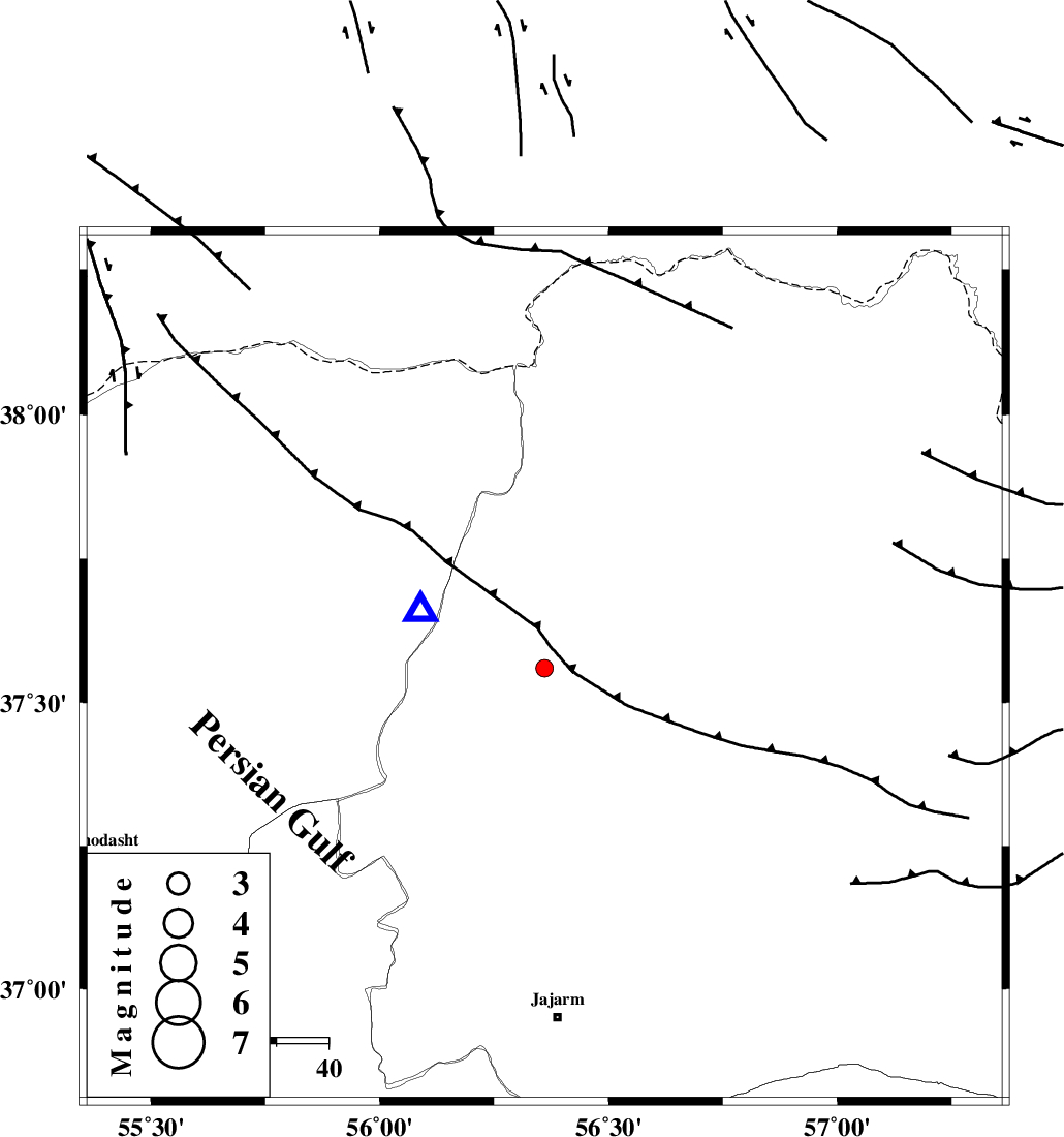
| Location | Lat:37.56 Lon: 56.36 |
| Region | Khorasan(north) Province, 51 km West of Ashkhaneh |
Nearest Cities |
|
| 20 km South of Garmab, Khorasan(north) Province | |
| 38 km East of Golidagh, Golestan Province | |
| 40 km South East of Qazanqayeh, Golestan Province | |
| 49 km North West of Shogan, Khorasan(north) Province | |
| 51 km North West of Ashkhaneh, Khorasan(north) Province | |
| Depth | 42 km |
| Agency | |
Faults within 150 km: |
|
| ROBATE_QARABIL_F (Length: 168 km) , Distance to epicenter: 30 km | |
| ESFARAYEN_F (Length: 111 km) , Distance to epicenter: 57 km | |
| JAJARAM_F (Length: 77 km) , Distance to epicenter: 62 km | |
| Number of Phases | 5 |
| RMS | 0.2 |
| Number of Stations | 3 |
| Error in Latitude | >3 km |
| Error in Longitude | 4.4 km |
| Error in Depth | 3.9 km |
Download waveform in seisan format
to download seisan software Click here
to access information about IIEES stations Click here
Amplitude | ||||||||
| UID | Agency | Station | Component | Amplitude | Period | Arrival Time | Proccessing Time | Signal Clip |
| 84656 | IIEES | MRVT | E | 397.4 | 0.28 | 2012-07-28 19:13:05 | 2012-07-29 01:46:00 | n |
| 84657 | IIEES | SHRO | N | 40.9 | 0.64 | 2012-07-28 19:13:45 | 2012-07-29 01:46:00 | n |
Phase | ||||||||||||
| Agency | Station | Component | Phase Type | Phase Quality | First Motion | Observed Arrival Time | Time Residual | Loc. Flag | Input Weight | Distance | Azimuth | |
| IIEES | MRVT | Z | Pg | E | 2012-07-28 19:12:57 | -0.37 | y | 26.5 | 295 | |||
| IIEES | MRVT | N | Sg | E | 2012-07-28 19:13:04 | 0.25 | y | 26.5 | 295 | |||
| IIEES | BJRD | Z | Pg | E | 2012-07-28 19:13:06 | 0.04 | y | 93.6 | 80 | |||
| IIEES | SHRO | Z | Pn | E | 2012-07-28 19:13:17 | 0.11 | y | 175 | 190 | |||
| IIEES | SHRO | N | Sg | E | 2012-07-28 19:13:39 | -0.04 | y | 175 | 190 | |||