
Magnitude |
:2.3 |
| Date & Time (UTC) | 2012-07-27 15:12:11.1 |
| Date & Time (Local) | 1391/5/6 19:42:11.1 |
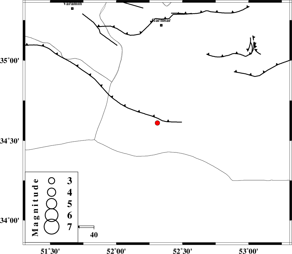
| Location | Lat:34.61 Lon: 52.31 |
| Region | Semnan Province, 67 km South of Garmsar |
Nearest Cities |
|
| 54 km North East of Marnejab, Esfahan Province | |
| 63 km South West of Gardovan, Semnan Province | |
| 65 km South of Lajran, Semnan Province | |
| 68 km South of Garmsar, Semnan Province | |
| 69 km South West of Davarabad, Semnan Province | |
| Depth | 14 km |
| Agency | |
Faults within 150 km: |
|
| SIAHKUH_F (Length: 154 km) , Distance to epicenter: 3 km | |
| KUH_E_GACHAB_F1 (Length: 53 km) , Distance to epicenter: 59 km | |
| PISHAV_F (Length: 34 km) , Distance to epicenter: 60 km | |
| Number of Phases | 4 |
| RMS | 0.1 |
| Number of Stations | 4 |
| Error in Latitude | >2.2 km |
| Error in Longitude | 4.3 km |
| Error in Depth | 5.7 km |
Download waveform in seisan format
to download seisan software Click here
to access information about IIEES stations Click here
Amplitude | ||||||||
| UID | Agency | Station | Component | Amplitude | Period | Arrival Time | Proccessing Time | Signal Clip |
| 84608 | IIEES | GHVR | E | 75.2 | 0.24 | 2012-07-27 15:12:39 | 2012-07-27 03:37:00 | n |
| 84609 | IIEES | THKV | N | 31.5 | 0.36 | 2012-07-27 15:13:08 | 2012-07-27 03:37:00 | n |
Phase | ||||||||||||
| Agency | Station | Component | Phase Type | Phase Quality | First Motion | Observed Arrival Time | Time Residual | Loc. Flag | Input Weight | Distance | Azimuth | |
| IIEES | GHVR | Z | Pg | E | 2012-07-27 15:12:27 | -0.11 | y | 98.4 | 262 | |||
| IIEES | DAMV | Z | Pg | E | 2012-07-27 15:12:30 | -0.02 | y | 117 | 345 | |||
| IIEES | THKV | N | Sg | E | 2012-07-27 15:13:06 | 0.05 | y | 194 | 319 | |||
| IIEES | KHMZ | Z | Pn | E | 2012-07-27 15:12:48 | 0.08 | y | 237 | 247 | |||