
Magnitude |
:2.6 |
| Date & Time (UTC) | 2012-07-18 21:18:49.6 |
| Date & Time (Local) | 1391/4/29 01:48:49.6 |
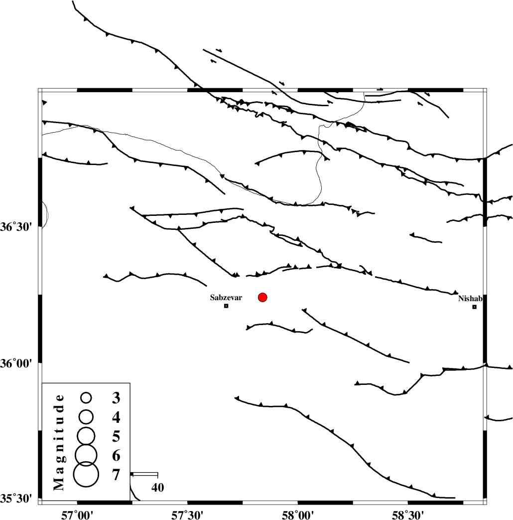
| Location | Lat:36.24 Lon: 57.84 |
| Region | Khorasan(center) Province, 15 km East of Sabzevar |
Nearest Cities |
|
| 15 km North East of Sabzevar, Khorasan(center) Province | |
| 28 km South West of Soltanabad, Khorasan(center) Province | |
| 29 km South West of Rebatjaz, Khorasan(center) Province | |
| 32 km North of Sheshtamad, Khorasan(center) Province | |
| 38 km South East of Void, Khorasan(center) Province | |
| Depth | 18 km |
| Agency | |
Faults within 150 km: |
|
| SABZEVAR_F (Length: 81 km) , Distance to epicenter: 12 km | |
| NAYSHABUR_F (Length: 74 km) , Distance to epicenter: 41 km | |
| RIVAND_F (Length: 70 km) , Distance to epicenter: 46 km | |
| Number of Phases | 5 |
| RMS | 0 |
| Number of Stations | 3 |
| Error in Latitude | >2.2 km |
| Error in Longitude | 3.8 km |
| Error in Depth | 3.6 km |
Download waveform in seisan format
to download seisan software Click here
to access information about IIEES stations Click here
Amplitude | ||||||||
| UID | Agency | Station | Component | Amplitude | Period | Arrival Time | Proccessing Time | Signal Clip |
| 84494 | IIEES | SHRO | N | 100.2 | 0.36 | 2012-07-18 21:19:41 | 2012-07-19 02:43:00 | n |
| 84495 | IIEES | SHRO | E | 60.3 | 0.48 | 2012-07-18 21:19:46 | 2012-07-19 02:43:00 | n |
Phase | ||||||||||||
| Agency | Station | Component | Phase Type | Phase Quality | First Motion | Observed Arrival Time | Time Residual | Loc. Flag | Input Weight | Distance | Azimuth | |
| IIEES | SHRO | Z | Pg | E | 2012-07-18 21:19:17 | 0.01 | y | 166 | 262 | |||
| IIEES | SHRO | E | Sg | E | 2012-07-18 21:19:37 | 0 | y | 166 | 262 | |||
| IIEES | BJRD | Z | Pg | E | 2012-07-18 21:19:17 | 0.01 | y | 166 | 347 | |||
| IIEES | BJRD | E | Sg | E | 2012-07-18 21:19:37 | 0 | y | 166 | 347 | |||
| IIEES | MRVT | Z | Pn | E | 2012-07-18 21:19:24 | -0.01 | y | 221 | 316 | |||