
Magnitude |
:1.9 |
| Date & Time (UTC) | 2012-07-09 13:38:40.2 |
| Date & Time (Local) | 1391/4/19 18:08:40.2 |
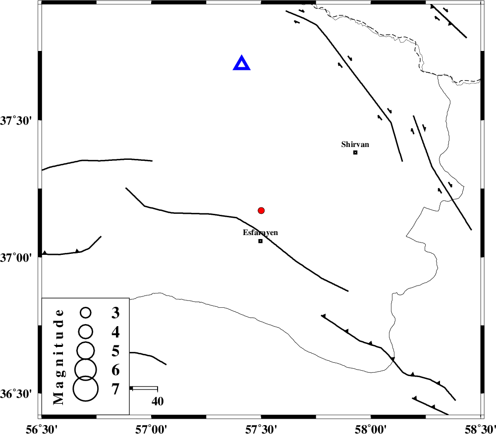
| Location | Lat:37.17 Lon: 57.5 |
| Region | Khorasan(north) Province, 12 km North of Esfarayen |
Nearest Cities |
|
| 10 km North of Eraj, Khorasan(north) Province | |
| 12 km North of Esfarayen, Khorasan(north) Province | |
| 14 km North of Parkanlu, Khorasan(north) Province | |
| 22 km North of Abbasabad, Khorasan(north) Province | |
| 23 km North East of Zarqabad, Khorasan(north) Province | |
| Depth | 38 km |
| Agency | |
Faults within 150 km: |
|
| ESFARAYEN_F (Length: 111 km) , Distance to epicenter: 8 km | |
| ROBATE_QARABIL_F (Length: 168 km) , Distance to epicenter: 48 km | |
| RIVAND_F (Length: 70 km) , Distance to epicenter: 49 km | |
| Number of Phases | 5 |
| RMS | 0.3 |
| Number of Stations | 3 |
| Error in Latitude | >3.3 km |
| Error in Longitude | 5.5 km |
| Error in Depth | 6.7 km |
Download waveform in seisan format
to download seisan software Click here
to access information about IIEES stations Click here
Amplitude | ||||||||
| UID | Agency | Station | Component | Amplitude | Period | Arrival Time | Proccessing Time | Signal Clip |
| 84432 | IIEES | BJRD | N | 51.8 | 0.48 | 2012-07-09 13:39:02 | 2012-07-09 02:09:00 | n |
| 84433 | IIEES | MRVT | E | 22.4 | 0.32 | 2012-07-09 13:39:27 | 2012-07-09 02:09:00 | n |
| 84434 | IIEES | MRVT | N | 21.7 | 0.48 | 2012-07-09 13:39:33 | 2012-07-09 02:09:00 | n |
| 84435 | IIEES | SHRO | E | 13.3 | 0.48 | 2012-07-09 13:39:39 | 2012-07-09 02:09:00 | n |
| 84436 | IIEES | SHRO | N | 15.7 | 0.52 | 2012-07-09 13:39:40 | 2012-07-09 02:09:00 | n |
Phase | ||||||||||||
| Agency | Station | Component | Phase Type | Phase Quality | First Motion | Observed Arrival Time | Time Residual | Loc. Flag | Input Weight | Distance | Azimuth | |
| IIEES | BJRD | N | Pg | E | 2012-07-09 13:38:51 | 0.16 | y | 59.7 | 352 | |||
| IIEES | MRVT | Z | Pg | E | 2012-07-09 13:39:02 | -0.5 | y | 137 | 294 | |||
| IIEES | MRVT | N | Sg | E | 2012-07-09 13:39:19 | 0.22 | y | 137 | 294 | |||
| IIEES | SHRO | Z | Pn | E | 2012-07-09 13:39:08 | 0.1 | y | 185 | 226 | |||
| IIEES | SHRO | N | Sg | E | 2012-07-09 13:39:32 | 0.03 | y | 185 | 226 | |||