
Magnitude |
:2.6 |
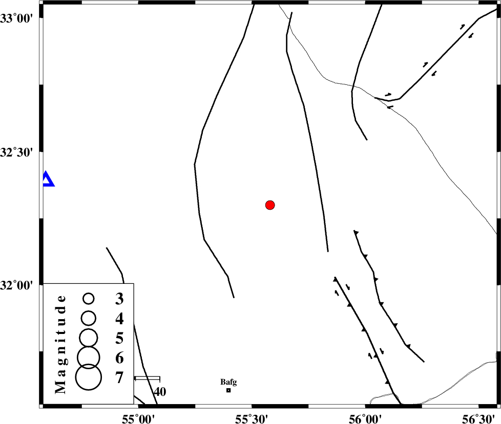
| Date & Time (UTC) | 2012-07-07 18:43:10.0 |
| Date & Time (Local) | 1391/4/17 23:13:10.0 |
| Location | Lat:32.3 Lon: 55.58 |
| Region | Yazd Province, 80 km North-East of Bafq |
Nearest Cities |
|
| 64 km North West of Behabad, Yazd Province | |
| 65 km North West of Kushk, Yazd Province | |
| 76 km North East of Mobarake, Yazd Province | |
| 79 km North West of Benestan, Yazd Province | |
| 79 km North East of Bafq, Yazd Province | |
| Depth | 18 km |
| Agency | |
Faults within 150 km: |
|
| SARBALA_F (Length: 92 km) , Distance to epicenter: 23 km | |
| POSHT_E_BADAM_F (Length: 128 km) , Distance to epicenter: 30 km | |
| JAFARABAD_F (Length: 60 km) , Distance to epicenter: 36 km | |
| Number of Phases | 5 |
| RMS | 0.2 |
| Number of Stations | 3 |
| Error in Latitude | >2 km |
| Error in Longitude | 5 km |
| Error in Depth | 8.4 km |
Download waveform in seisan format
to download seisan software Click here
to access information about IIEES stations Click here
Amplitude | ||||||||
| UID | Agency | Station | Component | Amplitude | Period | Arrival Time | Proccessing Time | Signal Clip |
| 84409 | IIEES | TABS | N | 42.2 | 0.36 | 2012-07-07 18:44:14 | 2012-07-07 07:05:00 | n |
| 84410 | IIEES | NASN | N | 42.8 | 0.32 | 2012-07-07 18:44:20 | 2012-07-07 07:05:00 | n |
| 84411 | IIEES | NASN | E | 23.2 | 0.4 | 2012-07-07 18:44:22 | 2012-07-07 07:05:00 | n |
| 84412 | IIEES | KRBR | N | 32.6 | 0.52 | 2012-07-07 18:44:32 | 2012-07-07 07:05:00 | n |
Phase | ||||||||||||
| Agency | Station | Component | Phase Type | Phase Quality | First Motion | Observed Arrival Time | Time Residual | Loc. Flag | Input Weight | Distance | Azimuth | |
| IIEES | TABS | Z | Pn | E | 2012-07-07 18:43:43 | -0.1 | y | 207 | 44 | |||
| IIEES | TABS | N | Sg | E | 2012-07-07 18:44:09 | 0.1 | y | 207 | 44 | |||
| IIEES | NASN | Z | Pn | E | 2012-07-07 18:43:50 | 0.16 | y | 266 | 283 | |||
| IIEES | KRBR | Z | Pn | E | 2012-07-07 18:43:52 | -0.43 | y | 281 | 156 | |||
| IIEES | KRBR | N | Sg | E | 2012-07-07 18:44:29 | 0.26 | y | 281 | 156 | |||