
Magnitude |
:3.9 |
| Date & Time (UTC) | 2012-07-04 19:10:15.0 |
| Date & Time (Local) | 1391/4/14 23:40:15.0 |
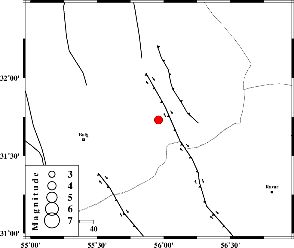
| Location | Lat:31.73 Lon: 55.96 |
| Region | Yazd Province, 55 km North-East of Bafq |
Nearest Cities |
|
| 12 km West of Benestan, Yazd Province | |
| 17 km East of Kushk, Yazd Province | |
| 17 km South of Behabad, Yazd Province | |
| 26 km North West of Asfih, Yazd Province | |
| 28 km North of Basab, Yazd Province | |
| Depth | 15 km |
| Agency | |
Faults within 150 km: |
|
| KUHBANAN_F (Length: 189 km) , Distance to epicenter: 11 km | |
| JAFARABAD_F (Length: 60 km) , Distance to epicenter: 21 km | |
| SARBALA_F (Length: 92 km) , Distance to epicenter: 45 km | |
| Number of Phases | 4 |
| RMS | 0 |
| Number of Stations | 4 |
| Error in Latitude | >1.6 km |
| Error in Longitude | 1.4 km |
| Error in Depth | 0 km |
Download waveform in seisan format
to download seisan software Click here
to access information about IIEES stations Click here
Amplitude | ||||||||
| UID | Agency | Station | Component | Amplitude | Period | Arrival Time | Proccessing Time | Signal Clip |
| 84384 | IIEES | KRBR | N | 1060.5 | 0.56 | 2012-07-04 19:11:18 | 2012-07-04 07:37:00 | n |
| 84385 | IIEES | KRBR | E | 1027.8 | 0.52 | 2012-07-04 19:11:19 | 2012-07-04 07:37:00 | n |
Phase | ||||||||||||
| Agency | Station | Component | Phase Type | Phase Quality | First Motion | Observed Arrival Time | Time Residual | Loc. Flag | Input Weight | Distance | Azimuth | |
| IIEES | KRBR | Z | Pn | E | 2012-07-04 19:10:48 | -0.01 | y | 208 | 158 | |||
| IIEES | TABS | N | Pn | E | 2012-07-04 19:10:52 | -0.02 | y | 239 | 27 | |||
| IIEES | NASN | Z | Pn | E | 2012-07-04 19:11:02 | 0.01 | y | 320 | 293 | |||
| IIEES | SHRT | Z | Pn | E | 2012-07-04 19:11:19 | 0.02 | y | 458 | 61 | |||