
Magnitude |
:3 |
| Date & Time (UTC) | 2012-07-04 07:30:31.8 |
| Date & Time (Local) | 1391/4/14 12:00:31.8 |
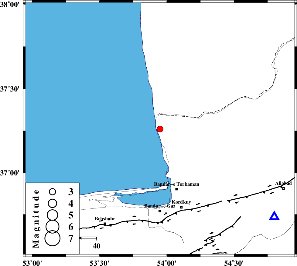
| Location | Lat:37.26 Lon: 53.95 |
| Region | Golestan Province, 42 km North-West of Bandar-e torkaman |
Nearest Cities |
|
| 22 km North West of Gomishtappeh, Golestan Province | |
| 37 km North West of Banavar, Golestan Province | |
| 41 km North West of Bandar-e torkaman, Golestan Province | |
| 45 km North West of Sijval, Golestan Province | |
| 53 km North West of Aq Qaleh, Golestan Province | |
| Depth | 14 km |
| Agency | |
Faults within 150 km: |
|
| KHAZAR_F (Length: 523 km) , Distance to epicenter: 55 km | |
| N_ALBORZ_F (Length: 360 km) , Distance to epicenter: 81 km | |
| SHAVAR_F (Length: 87 km) , Distance to epicenter: 87 km | |
| Number of Phases | 6 |
| RMS | 0.1 |
| Number of Stations | 6 |
| Error in Latitude | >3 km |
| Error in Longitude | 4 km |
| Error in Depth | 8 km |
Download waveform in seisan format
to download seisan software Click here
to access information about IIEES stations Click here
Amplitude | ||||||||
| UID | Agency | Station | Component | Amplitude | Period | Arrival Time | Proccessing Time | Signal Clip |
| 84379 | IIEES | THKV | E | 56.4 | 0.53 | 2012-07-04 07:32:12 | 2012-07-04 08:03:00 | n |
Phase | ||||||||||||
| Agency | Station | Component | Phase Type | Phase Quality | First Motion | Observed Arrival Time | Time Residual | Loc. Flag | Input Weight | Distance | Azimuth | |
| IIEES | MRVT | Z | Pg | E | 2012-07-04 07:31:03 | 0.01 | y | 195 | 76 | |||
| IIEES | SHRO | Z | Pg | E | 2012-07-04 07:31:09 | 0.01 | y | 231 | 126 | |||
| IIEES | SHRO | E | Sg | E | 2012-07-04 07:31:37 | -0.07 | y | 231 | 126 | |||
| IIEES | DAMV | Z | Pn | E | 2012-07-04 07:31:11 | 0.17 | y | 253 | 225 | |||
| IIEES | CHTH | Z | Pn | E | 2012-07-04 07:31:15 | -0.21 | y | 294 | 240 | |||
| IIEES | TABS | Z | Pn | E | 2012-07-04 07:31:40 | 0.11 | y | 494 | 143 | |||