
Magnitude |
:2.9 |
| Date & Time (UTC) | 2012-06-28 13:33:47.2 |
| Date & Time (Local) | 1391/4/8 18:03:47.2 |
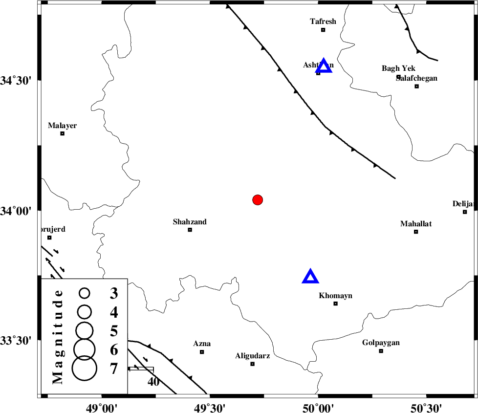
| Location | Lat:34.04 Lon: 49.72 |
| Region | Markazi Province, 6 km Arak |
Nearest Cities |
|
| 6 km of Arak, Markazi Province | |
| 13 km of Marzijaran, Markazi Province | |
| 13 km East of Sanjan, Markazi Province | |
| 15 km North of Qasemabad, Markazi Province | |
| 20 km North West of Amanabad, Markazi Province | |
| Depth | 15 km |
| Agency | |
Faults within 150 km: |
|
| TAFRESH_F (Length: 117 km) , Distance to epicenter: 42 km | |
| MAIN_ZAGROS_R_F (Length: 1106 km) , Distance to epicenter: 78 km | |
| DORUD (Length: 100 km) , Distance to epicenter: 84 km | |
| Number of Phases | 6 |
| RMS | 0.3 |
| Number of Stations | 4 |
| Error in Latitude | >2.9 km |
| Error in Longitude | 7.2 km |
| Error in Depth | 7 km |
Download waveform in seisan format
to download seisan software Click here
to access information about IIEES stations Click here
Amplitude | ||||||||
| UID | Agency | Station | Component | Amplitude | Period | Arrival Time | Proccessing Time | Signal Clip |
| 84276 | IIEES | KHMZ | N | 978.8 | 0.22 | 2012-06-28 13:34:01 | 2012-06-28 01:57:00 | n |
| 84277 | IIEES | KHMZ | E | 1560.4 | 0.24 | 2012-06-28 13:34:02 | 2012-06-28 01:57:00 | n |
| 84278 | IIEES | GHVR | E | 182.1 | 0.32 | 2012-06-28 13:34:36 | 2012-06-28 01:57:00 | n |
| 84279 | IIEES | GHVR | N | 159.5 | 0.28 | 2012-06-28 13:34:37 | 2012-06-28 01:57:00 | n |
Phase | ||||||||||||
| Agency | Station | Component | Phase Type | Phase Quality | First Motion | Observed Arrival Time | Time Residual | Loc. Flag | Input Weight | Distance | Azimuth | |
| IIEES | KHMZ | Z | Pg | E | 2012-06-28 13:33:55 | 0.23 | y | 40.1 | 145 | |||
| IIEES | ASAO | Z | Pg | E | 2012-06-28 13:33:58 | 0.25 | y | 63.6 | 27 | |||
| IIEES | ASAO | E | Sg | E | 2012-06-28 13:34:06 | 0.11 | y | 63.6 | 27 | |||
| IIEES | GHVR | Z | Pn | E | 2012-06-28 13:34:12 | -0.65 | y | 149 | 70 | |||
| IIEES | GHVR | E | Sg | E | 2012-06-28 13:34:30 | 0.12 | y | 149 | 70 | |||
| IIEES | THKV | E | Sg | E | 2012-06-28 13:34:53 | -0.07 | y | 234 | 27 | |||