
Magnitude |
:4.3 |
| Date & Time (UTC) | 2012-06-27 02:25:39.7 |
| Date & Time (Local) | 1391/4/7 06:55:39.7 |
| Location | Lat:34.14 Lon: 48.49 |
| Region | Hamedan Province, 13 km East of Nahavand |
Nearest Cities |
|
| 8 km North of Babaqasem, Hamedan Province | |
| 8 km North of Anuj, Hamedan Province | |
| 11 km North of Jaefarabad, Lorestan Province | |
| 13 km South of Avarzman, Hamedan Province | |
| 13 km East of Nahavand, Hamedan Province | |
| Depth | 15 km |
| Agency | |
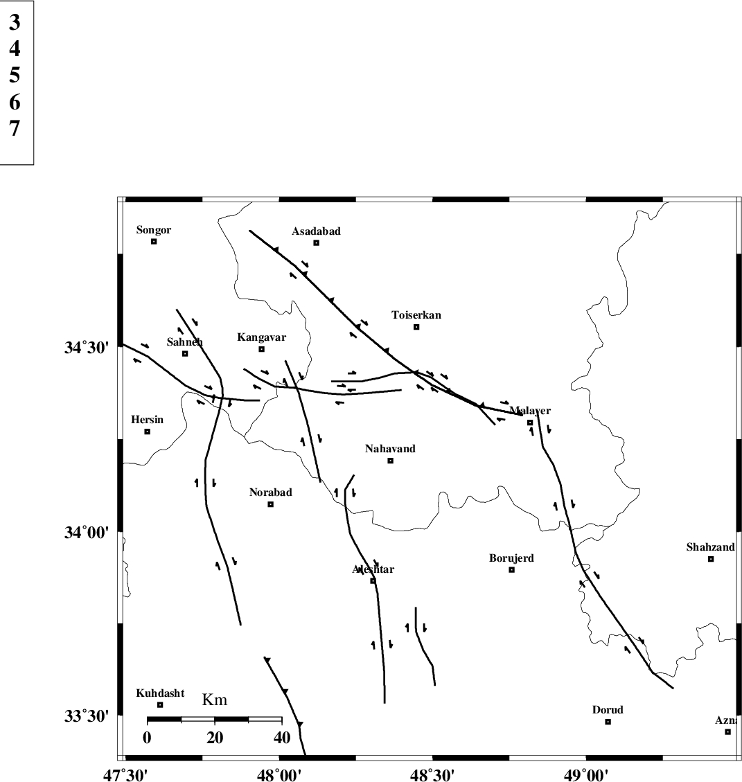
Faults within 150 km: |
|
| NAHAVAND_F (Length: 102 km) , Distance to epicenter: 8 km | |
| SAHANEH_F (Length: 77 km) , Distance to epicenter: 22 km | |
| DORUD (Length: 100 km) , Distance to epicenter: 45 km | |
| Number of Phases | 5 |
| RMS | 0 |
| Number of Stations | 5 |
| Error in Latitude | >1.4 km |
| Error in Longitude | 1.7 km |
| Error in Depth | 0 km |
Download waveform in seisan format
to download seisan software Click here
to access information about IIEES stations Click here
Amplitude | ||||||||
| UID | Agency | Station | Component | Amplitude | Period | Arrival Time | Proccessing Time | Signal Clip |
| 84261 | IIEES | SHGR | N | 1738.7 | 0.52 | 2012-06-27 02:26:53 | 2012-06-27 03:09:00 | n |
| 84262 | IIEES | SHGR | E | 1669.9 | 0.68 | 2012-06-27 02:26:58 | 2012-06-27 03:09:00 | n |
| 84263 | IIEES | GHVR | N | 2160.7 | 0.6 | 2012-06-27 02:26:58 | 2012-06-27 03:09:00 | n |
| 84264 | IIEES | GHVR | E | 1960.7 | 0.6 | 2012-06-27 02:27:02 | 2012-06-27 03:09:00 | n |
Phase | ||||||||||||
| Agency | Station | Component | Phase Type | Phase Quality | First Motion | Observed Arrival Time | Time Residual | Loc. Flag | Input Weight | Distance | Azimuth | |
| IIEES | SHGR | Z | Pn | E | 2012-06-27 02:26:15 | -0.01 | y | 227 | 173 | |||
| IIEES | GHVR | Z | Pn | E | 2012-06-27 02:26:19 | 0.01 | y | 256 | 81 | |||
| IIEES | ZNJK | Z | Pn | E | 2012-06-27 02:26:22 | -0.06 | y | 281 | 4 | |||
| IIEES | NASN | Z | Pn | E | 2012-06-27 02:26:40 | 0.01 | y | 428 | 109 | |||
| IIEES | GRMI | Z | Pn | E | 2012-06-27 02:26:52 | 0.09 | y | 521 | 354 | |||