
Magnitude |
:2.6 |
| Date & Time (UTC) | 2012-06-25 03:22:29.2 |
| Date & Time (Local) | 1391/4/5 07:52:29.2 |
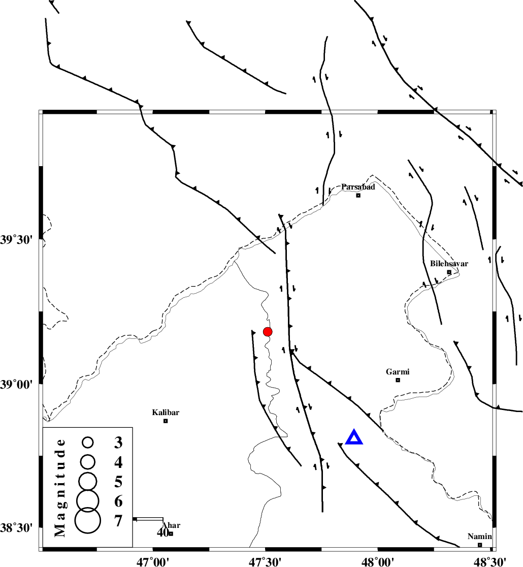
| Location | Lat:39.18 Lon: 47.51 |
| Region | Azarbaijan Sharghi Province, 53 km North-West of Germi |
Nearest Cities |
|
| 15 km South of Buran olia, Ardebil Province | |
| 17 km North East of Abesh ahmad, Azarbaijan Sharghi Province | |
| 20 km North of Aq baraz, Azarbaijan Sharghi Province | |
| 23 km North West of Qareh aqaj-e paein, Ardebil Province | |
| 26 km North West of Tazehkand-eankut, Ardebil Province | |
| Depth | 14 km |
| Agency | |
Faults within 150 km: |
|
| DASHT_E_MOGHAN__ (Length: 104 km) , Distance to epicenter: 13 km | |
| TALESH_F (Length: 258 km) , Distance to epicenter: 58 km | |
| BOZQUSH (Length: 70 km) , Distance to epicenter: 122 km | |
| Number of Phases | 5 |
| RMS | 0 |
| Number of Stations | 4 |
| Error in Latitude | >9.5 km |
| Error in Longitude | 5.4 km |
| Error in Depth | 4.9 km |
Download waveform in seisan format
to download seisan software Click here
to access information about IIEES stations Click here
Amplitude | ||||||||
| UID | Agency | Station | Component | Amplitude | Period | Arrival Time | Proccessing Time | Signal Clip |
| 84242 | IIEES | GRMI | N | 340.2 | 0.25 | 2012-06-25 03:22:45 | 2012-06-25 03:39:00 | n |
| 84243 | IIEES | GRMI | E | 627.4 | 0.32 | 2012-06-25 03:22:46 | 2012-06-25 03:39:00 | n |
| 84244 | IIEES | MAKU | N | 33.4 | 0.2 | 2012-06-25 03:23:40 | 2012-06-25 03:39:00 | n |
| 84245 | IIEES | MAKU | E | 28.5 | 0.32 | 2012-06-25 03:23:41 | 2012-06-25 03:39:00 | n |
Phase | ||||||||||||
| Agency | Station | Component | Phase Type | Phase Quality | First Motion | Observed Arrival Time | Time Residual | Loc. Flag | Input Weight | Distance | Azimuth | |
| IIEES | GRMI | Z | Pg | E | 2012-06-25 03:22:38 | -0.03 | y | 52.9 | 141 | |||
| IIEES | MAKU | Z | Pg | E | 2012-06-25 03:23:09 | 0.04 | y | 245 | 275 | |||
| IIEES | MAKU | E | Sg | E | 2012-06-25 03:23:38 | -0.04 | y | 245 | 275 | |||
| IIEES | ZNJK | Z | Pn | E | 2012-06-25 03:23:14 | -0.02 | y | 297 | 159 | |||
| IIEES | SNGE | Z | Pn | E | 2012-06-25 03:23:33 | 0.05 | y | 454 | 182 | |||