
Magnitude |
:3.8 |
| Date & Time (UTC) | 2012-06-22 02:46:32.0 |
| Date & Time (Local) | 1391/4/2 07:16:32.0 |
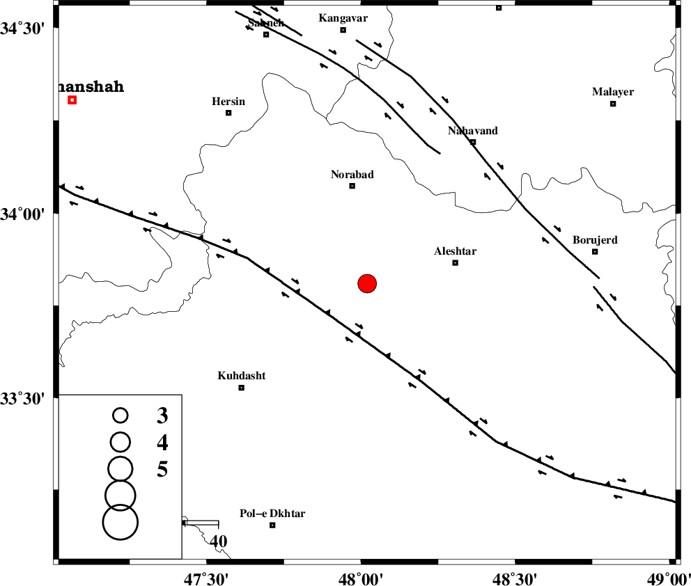
| Location | Lat:33.81 Lon: 48.02 |
| Region | Lorestan Province, 30 km South of Nurabad |
Nearest Cities |
|
| 15 km West of Firuz Abad, Lorestan Province | |
| 18 km South of Farhadabad, Lorestan Province | |
| 24 km West of Dehrahim, Lorestan Province | |
| 26 km North West of Siyahpush, Lorestan Province | |
| 27 km West of Aleshtar, Lorestan Province | |
| Depth | 41 km |
| Agency | |
Faults within 150 km: |
|
| HZF4 (Length: 492 km) , Distance to epicenter: 15 km | |
| SAHANEH_F (Length: 77 km) , Distance to epicenter: 45 km | |
| NAHAVAND_F (Length: 102 km) , Distance to epicenter: 51 km | |
| Number of Phases | 6 |
| RMS | 0.4 |
| Number of Stations | 4 |
| Error in Latitude | >3.7 km |
| Error in Longitude | 5.6 km |
| Error in Depth | 7 km |
Download waveform in seisan format
to download seisan software Click here
to access information about IIEES stations Click here
Amplitude | ||||||||
| UID | Agency | Station | Component | Amplitude | Period | Arrival Time | Proccessing Time | Signal Clip |
| 84217 | IIEES | SNGE | E | 1271.2 | 0.76 | 2012-06-22 02:47:24 | 2012-06-22 03:23:00 | n |
| 84218 | IIEES | SNGE | N | 1026.9 | 0.52 | 2012-06-22 02:47:27 | 2012-06-22 03:23:00 | n |
| 84219 | IIEES | KHMZ | N | 621.1 | 0.52 | 2012-06-22 02:47:28 | 2012-06-22 03:23:00 | n |
| 84220 | IIEES | KHMZ | E | 928.6 | 0.52 | 2012-06-22 02:47:29 | 2012-06-22 03:23:00 | n |
| 84221 | IIEES | ASAO | E | 638.3 | 0.52 | 2012-06-22 02:47:40 | 2012-06-22 03:23:00 | n |
| 84222 | IIEES | SHGR | E | 2276.4 | 0.48 | 2012-06-22 02:47:30 | 2012-06-22 03:23:00 | n |
| 84223 | IIEES | SHGR | N | 1545.4 | 0.48 | 2012-06-22 02:47:30 | 2012-06-22 03:23:00 | n |
Phase | ||||||||||||
| Agency | Station | Component | Phase Type | Phase Quality | First Motion | Observed Arrival Time | Time Residual | Loc. Flag | Input Weight | Distance | Azimuth | |
| IIEES | SNGE | Z | Pg | E | 2012-06-22 02:46:57 | 0.03 | y | 155 | 337 | |||
| IIEES | KHMZ | Z | Pn | E | 2012-06-22 02:46:59 | -0.43 | y | 180 | 92 | |||
| IIEES | KHMZ | N | Sg | E | 2012-06-22 02:47:23 | 0.34 | y | 180 | 92 | |||
| IIEES | SHGR | Z | Pn | E | 2012-06-22 02:47:03 | 0.72 | y | 202 | 159 | |||
| IIEES | ASAO | Z | Pn | E | 2012-06-22 02:47:02 | -0.27 | y | 202 | 66 | |||
| IIEES | SHGR | N | Sg | E | 2012-06-22 02:47:28 | -0.38 | y | 202 | 159 | |||