
Magnitude |
:3 |
| Date & Time (UTC) | 2012-06-08 18:31:46.6 |
| Date & Time (Local) | 1391/3/19 23:01:46.6 |
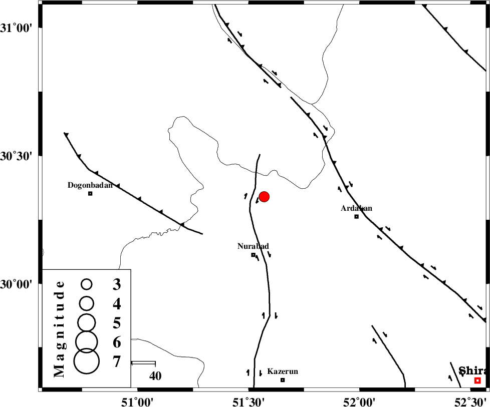
| Location | Lat:30.34 Lon: 51.57 |
| Region | Fars Province, 26 km North of Nurabad |
Nearest Cities |
|
| 12 km North of Masiri, Fars Province | |
| 18 km North East of Dehnumoqimi, Fars Province | |
| 20 km North East of Fahlian-e olia, Fars Province | |
| 20 km East of Chehar taq, Fars Province | |
| 26 km North of Nurabad, Fars Province | |
| Depth | 45 km |
| Agency | |
Faults within 150 km: |
|
| KAZERUN_F (Length: 96 km) , Distance to epicenter: 5 km | |
| MISHAN_F (Length: 76 km) , Distance to epicenter: 31 km | |
| HZF3 (Length: 197 km) , Distance to epicenter: 33 km | |
| Number of Phases | 5 |
| RMS | 0.2 |
| Number of Stations | 3 |
| Error in Latitude | >4.2 km |
| Error in Longitude | 5.8 km |
| Error in Depth | 8.8 km |
Download waveform in seisan format
to download seisan software Click here
to access information about IIEES stations Click here
Amplitude | ||||||||
| UID | Agency | Station | Component | Amplitude | Period | Arrival Time | Proccessing Time | Signal Clip |
| 84074 | IIEES | AHRM | N | 261.8 | 0.44 | 2012-06-08 18:32:38 | 2012-06-09 12:57:00 | n |
| 84075 | IIEES | GHIR | N | 81.6 | 0.52 | 2012-06-08 18:33:12 | 2012-06-09 12:57:00 | n |
| 84076 | IIEES | GHIR | E | 61.1 | 0.52 | 2012-06-08 18:33:20 | 2012-06-09 12:57:00 | n |
Phase | ||||||||||||
| Agency | Station | Component | Phase Type | Phase Quality | First Motion | Observed Arrival Time | Time Residual | Loc. Flag | Input Weight | Distance | Azimuth | |
| IIEES | AHRM | Z | Pg | E | 2012-06-08 18:32:13 | -0.39 | y | 166 | 189 | |||
| IIEES | AHRM | N | Sg | E | 2012-06-08 18:32:34 | 0.31 | y | 166 | 189 | |||
| IIEES | GHIR | Z | Pn | E | 2012-06-08 18:32:24 | -0.09 | y | 266 | 149 | |||
| IIEES | GHIR | Z | Sg | E | 2012-06-08 18:33:00 | 0.02 | y | 266 | 149 | |||
| IIEES | NASN | N | Pn | E | 2012-06-08 18:32:28 | 0.16 | y | 296 | 23 | |||