
Magnitude |
:1.9 |
| Date & Time (UTC) | 2012-06-07 07:45:02.3 |
| Date & Time (Local) | 1391/3/18 12:15:02.3 |
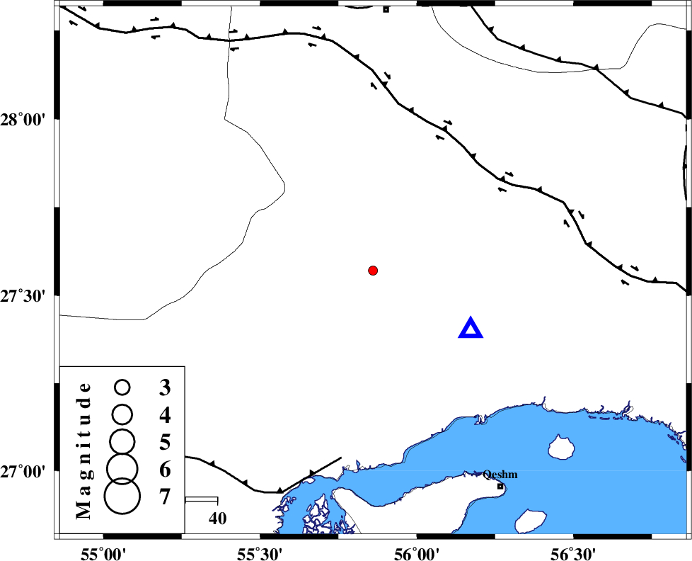
| Location | Lat:27.57 Lon: 55.86 |
| Region | Hormozgan Province, 83 km South of Hajiabad |
Nearest Cities |
|
| 8 km of Fin, Hormozgan Province | |
| 54 km South East of Darz, Fars Province | |
| 60 km North West of Bandar-e abbas, Hormozgan Province | |
| 62 km South West of Fareqan, Hormozgan Province | |
| 74 km North East of Bandar-e khamir, Hormozgan Province | |
| Depth | 14 km |
| Agency | |
Faults within 150 km: |
|
| HZF2 (Length: 437 km) , Distance to epicenter: 47 km | |
| MFF1 (Length: 180 km) , Distance to epicenter: 60 km | |
| MAIN_ZAGROS_R_F (Length: 1106 km) , Distance to epicenter: 83 km | |
| Number of Phases | 5 |
| RMS | 0.2 |
| Number of Stations | 3 |
| Error in Latitude | >2.6 km |
| Error in Longitude | 2.2 km |
| Error in Depth | 5.9 km |
Download waveform in seisan format
to download seisan software Click here
to access information about IIEES stations Click here
Amplitude | ||||||||
| UID | Agency | Station | Component | Amplitude | Period | Arrival Time | Proccessing Time | Signal Clip |
| 84009 | IIEES | BNDS | N | 143.7 | 0.32 | 2012-06-07 07:45:25 | 2012-06-07 08:10:00 | n |
| 84010 | IIEES | BNDS | E | 137.6 | 0.39 | 2012-06-07 07:45:28 | 2012-06-07 08:10:00 | n |
Phase | ||||||||||||
| Agency | Station | Component | Phase Type | Phase Quality | First Motion | Observed Arrival Time | Time Residual | Loc. Flag | Input Weight | Distance | Azimuth | |
| IIEES | BNDS | Z | Pg | E | 2012-06-07 07:45:09 | -0.16 | y | 36.3 | 120 | |||
| IIEES | KRBR | Z | Pn | E | 2012-06-07 07:45:45 | 0.24 | y | 282 | 18 | |||
| IIEES | KRBR | E | Sg | E | 2012-06-07 07:46:21 | -0.13 | y | 282 | 18 | |||
| IIEES | GHIR | Z | Pn | E | 2012-06-07 07:45:46 | 0.32 | y | 293 | 286 | |||
| IIEES | GHIR | N | Sg | E | 2012-06-07 07:46:24 | -0.26 | y | 293 | 286 | |||