
Magnitude |
:2.8 |
| Date & Time (UTC) | 2012-06-02 13:40:50.4 |
| Date & Time (Local) | 1391/3/13 18:10:50.4 |
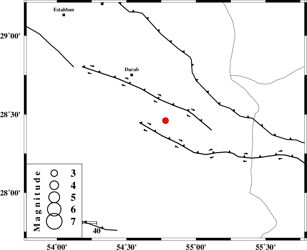
| Location | Lat:28.46 Lon: 54.78 |
| Region | Fars Province, 40 km South-East of Darab |
Nearest Cities |
|
| 22 km South of Dehkheyr, Fars Province | |
| 29 km North West of Rostaq, Fars Province | |
| 37 km North East of Hajiabad, Fars Province | |
| 38 km South East of Shahnan, Fars Province | |
| 40 km South East of Darab, Fars Province | |
| Depth | 18 km |
| Agency | |
Faults within 150 km: |
|
| HZF2 (Length: 437 km) , Distance to epicenter: 11 km | |
| HZF1 (Length: 102 km) , Distance to epicenter: 12 km | |
| MAIN_ZAGROS_R_F (Length: 1106 km) , Distance to epicenter: 36 km | |
| Number of Phases | 4 |
| RMS | 0.1 |
| Number of Stations | 3 |
| Error in Latitude | >2 km |
| Error in Longitude | 1.7 km |
| Error in Depth | 4.2 km |
Download waveform in seisan format
to download seisan software Click here
to access information about IIEES stations Click here
Amplitude | ||||||||
| UID | Agency | Station | Component | Amplitude | Period | Arrival Time | Proccessing Time | Signal Clip |
| 83855 | IIEES | GHIR | E | 88.2 | 0.44 | 2012-06-02 13:41:49 | 2012-06-02 01:56:00 | n |
| 83856 | IIEES | GHIR | N | 118.7 | 0.48 | 2012-06-02 13:41:51 | 2012-06-02 01:56:00 | n |
| 83857 | IIEES | BNDS | E | 115.5 | 0.52 | 2012-06-02 13:41:50 | 2012-06-02 01:56:00 | n |
| 83858 | IIEES | BNDS | N | 90.6 | 0.4 | 2012-06-02 13:41:54 | 2012-06-02 01:56:00 | n |
| 83859 | IIEES | KRBR | E | 44.3 | 0.76 | 2012-06-02 13:42:15 | 2012-06-02 01:56:00 | n |
Phase | ||||||||||||
| Agency | Station | Component | Phase Type | Phase Quality | First Motion | Observed Arrival Time | Time Residual | Loc. Flag | Input Weight | Distance | Azimuth | |
| IIEES | GHIR | Z | Pg | E | 2012-06-02 13:41:19 | 0.03 | y | 176 | 264 | |||
| IIEES | BNDS | Z | Pg | E | 2012-06-02 13:41:20 | 0 | y | 181 | 130 | |||
| IIEES | KRBR | Z | Pn | E | 2012-06-02 13:41:29 | -0.1 | y | 256 | 48 | |||
| IIEES | KRBR | N | Sg | E | 2012-06-02 13:42:03 | 0.07 | y | 256 | 48 | |||