
Magnitude |
:3.5 |
| Date & Time (UTC) | 2012-05-21 20:34:26.8 |
| Date & Time (Local) | 1391/3/2 01:04:26.8 |
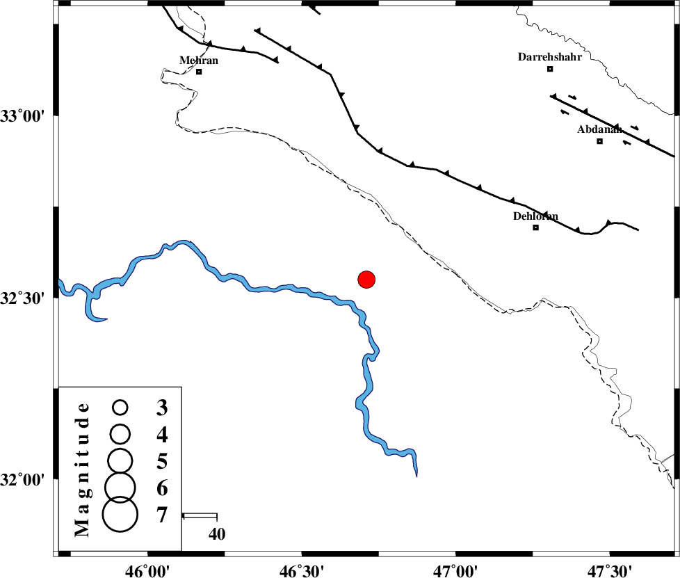
| Location | Lat:32.55 Lon: 46.71 |
| Region | Iraq, 54 km South-West of Dehloran |
Nearest Cities |
|
| 39 km South West of Bishehzar, Ilam Province | |
| 54 km South West of Dehloran, Ilam Province | |
| 61 km North West of Musian, Ilam Province | |
| 79 km South West of Meymeh, Ilam Province | |
| 79 km South East of Gonbad-e pirmohammad, Ilam Province | |
| Depth | 14 km |
| Agency | |
Faults within 150 km: |
|
| MFF6 (Length: 144 km) , Distance to epicenter: 37 km | |
| ZFF4 (Length: 128 km) , Distance to epicenter: 71 km | |
| BALARUD_F_Z1 (Length: 87 km) , Distance to epicenter: 79 km | |
| Number of Phases | 6 |
| RMS | 0.1 |
| Number of Stations | 5 |
| Error in Latitude | >5.4 km |
| Error in Longitude | 9.1 km |
| Error in Depth | 9.9 km |
Download waveform in seisan format
to download seisan software Click here
to access information about IIEES stations Click here
Amplitude | ||||||||
| UID | Agency | Station | Component | Amplitude | Period | Arrival Time | Proccessing Time | Signal Clip |
| 83729 | IIEES | SHGR | N | 811.9 | 0.36 | 2012-05-21 20:35:28 | 2012-05-21 08:59:00 | n |
| 83730 | IIEES | SHGR | E | 848.9 | 0.4 | 2012-05-21 20:35:41 | 2012-05-21 08:59:00 | n |
| 83731 | IIEES | SNGE | N | 322.2 | 0.96 | 2012-05-21 20:35:57 | 2012-05-21 08:59:00 | n |
| 83732 | IIEES | SNGE | E | 88.6 | 0.6 | 2012-05-21 20:35:58 | 2012-05-21 08:59:00 | n |
| 83733 | IIEES | GHVR | E | 38.9 | 0.48 | 2012-05-21 20:36:25 | 2012-05-21 08:59:00 | n |
| 83734 | IIEES | GHVR | N | 29.2 | 0.56 | 2012-05-21 20:36:40 | 2012-05-21 08:59:00 | n |
Phase | ||||||||||||
| Agency | Station | Component | Phase Type | Phase Quality | First Motion | Observed Arrival Time | Time Residual | Loc. Flag | Input Weight | Distance | Azimuth | |
| IIEES | SHGR | Z | Pn | E | 2012-05-21 20:34:59 | -0.02 | y | 203 | 103 | |||
| IIEES | SHGR | N | Sg | E | 2012-05-21 20:35:24 | -0.03 | y | 203 | 103 | |||
| IIEES | SNGE | Z | Pn | E | 2012-05-21 20:35:10 | -0.04 | y | 288 | 12 | |||
| IIEES | KHMZ | Z | Pn | E | 2012-05-21 20:35:15 | 0.13 | y | 331 | 66 | |||
| IIEES | ASAO | Z | Pn | E | 2012-05-21 20:35:21 | -0.12 | y | 379 | 53 | |||
| IIEES | GHVR | Z | Pn | E | 2012-05-21 20:35:33 | 0.09 | y | 472 | 62 | |||