
Magnitude |
:3.4 |
| Date & Time (UTC) | 2012-05-19 12:54:15.7 |
| Date & Time (Local) | 1391/2/30 17:24:15.7 |
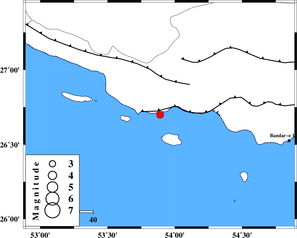
| Location | Lat:26.7 Lon: 53.89 |
| Region | Persian Gulf, 73 km South-West of Bastak |
Nearest Cities |
|
| 53 km South West of Jenah, Hormozgan Province | |
| 54 km South East of Ahl, Fars Province | |
| 64 km South East of Ashkenan, Fars Province | |
| 73 km South West of Bastak, Hormozgan Province | |
| 89 km South East of Beyram, Fars Province | |
| Depth | 38 km |
| Agency | |
Faults within 150 km: |
|
| ZFF1 (Length: 165 km) , Distance to epicenter: 4 km | |
| MFF3 (Length: 292 km) , Distance to epicenter: 27 km | |
| MFF1 (Length: 180 km) , Distance to epicenter: 45 km | |
| Number of Phases | 4 |
| RMS | 0 |
| Number of Stations | 3 |
| Error in Latitude | >10.3 km |
| Error in Longitude | 2.6 km |
| Error in Depth | 5.1 km |
Download waveform in seisan format
to download seisan software Click here
to access information about IIEES stations Click here
Amplitude | ||||||||
| UID | Agency | Station | Component | Amplitude | Period | Arrival Time | Proccessing Time | Signal Clip |
| 83693 | IIEES | GHIR | E | 322.1 | 0.4 | 2012-05-19 12:55:16 | 2012-05-19 01:23:00 | n |
| 83694 | IIEES | BNDS | N | 217.3 | 0.44 | 2012-05-19 12:55:29 | 2012-05-19 01:23:00 | n |
| 83695 | IIEES | KRBR | E | 41.2 | 0.44 | 2012-05-19 12:56:19 | 2012-05-19 01:23:00 | n |
Phase | ||||||||||||
| Agency | Station | Component | Phase Type | Phase Quality | First Motion | Observed Arrival Time | Time Residual | Loc. Flag | Input Weight | Distance | Azimuth | |
| IIEES | GHIR | Z | Pg | E | 2012-05-19 12:54:47 | 0 | y | 197 | 333 | |||
| IIEES | BNDS | Z | Pn | E | 2012-05-19 12:54:51 | 0 | y | 239 | 71 | |||
| IIEES | BNDS | N | Sg | E | 2012-05-19 12:55:22 | 0 | y | 239 | 71 | |||
| IIEES | KRBR | Z | Pn | E | 2012-05-19 12:55:18 | 0 | y | 460 | 37 | |||