
Magnitude |
:3.3 |
| Date & Time (UTC) | 2012-05-12 05:24:34.3 |
| Date & Time (Local) | 1391/2/23 09:54:34.3 |
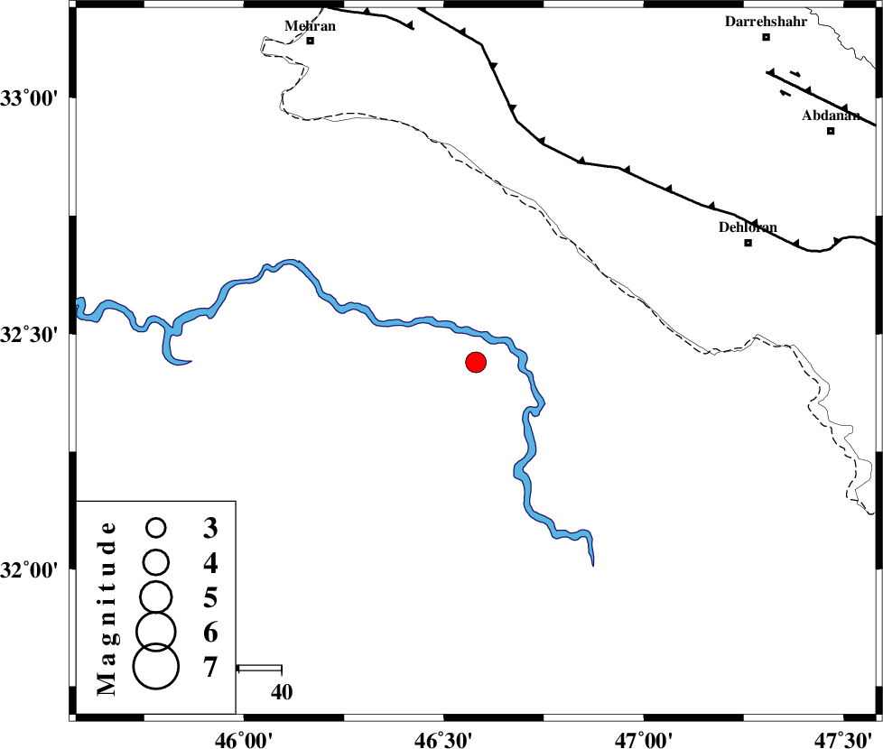
| Location | Lat:32.44 Lon: 46.58 |
| Region | Iraq, 70 km South-West of Dehloran |
Nearest Cities |
|
| 57 km South West of Bishehzar, Ilam Province | |
| 70 km South West of Dehloran, Ilam Province | |
| 74 km South West of Musian, Ilam Province | |
| 85 km South East of Mehran, Ilam Province | |
| 90 km South of Gonbad-e pirmohammad, Ilam Province | |
| Depth | 33 km |
| Agency | |
Faults within 150 km: |
|
| MFF6 (Length: 144 km) , Distance to epicenter: 53 km | |
| ZFF4 (Length: 128 km) , Distance to epicenter: 80 km | |
| MFF7 (Length: 99 km) , Distance to epicenter: 93 km | |
| Number of Phases | 8 |
| RMS | 0.3 |
| Number of Stations | 6 |
| Error in Latitude | >5.1 km |
| Error in Longitude | 9.6 km |
| Error in Depth | 6.8 km |
Download waveform in seisan format
to download seisan software Click here
to access information about IIEES stations Click here
Amplitude | ||||||||
| UID | Agency | Station | Component | Amplitude | Period | Arrival Time | Proccessing Time | Signal Clip |
| 83480 | IIEES | SHGR | E | 387.3 | 0.44 | 2012-05-12 05:25:41 | 2012-05-12 05:53:00 | n |
| 83481 | IIEES | SHGR | N | 328.5 | 0.58 | 2012-05-12 05:25:54 | 2012-05-12 05:53:00 | n |
| 83482 | IIEES | KHMZ | E | 63.6 | 0.46 | 2012-05-12 05:26:16 | 2012-05-12 05:53:00 | n |
| 83483 | IIEES | ASAO | E | 37.4 | 0.58 | 2012-05-12 05:26:28 | 2012-05-12 05:53:00 | n |
Phase | ||||||||||||
| Agency | Station | Component | Phase Type | Phase Quality | First Motion | Observed Arrival Time | Time Residual | Loc. Flag | Input Weight | Distance | Azimuth | |
| IIEES | SHGR | Z | Pg | E | 2012-05-12 05:25:08 | 0.01 | y | 213 | 99 | |||
| IIEES | SHGR | E | Sg | E | 2012-05-12 05:25:33 | 0.05 | y | 213 | 99 | |||
| IIEES | SNGE | Z | Pn | E | 2012-05-12 05:25:18 | 0.12 | y | 303 | 13 | |||
| IIEES | SNGE | E | Sg | E | 2012-05-12 05:25:57 | -0.07 | y | 303 | 13 | |||
| IIEES | KHMZ | Z | Pn | E | 2012-05-12 05:25:23 | 0.3 | y | 348 | 65 | |||
| IIEES | ASAO | Z | Pn | E | 2012-05-12 05:25:29 | -0.24 | y | 397 | 53 | |||
| IIEES | GHVR | Z | Pn | E | 2012-05-12 05:25:41 | 0.26 | y | 490 | 61 | |||
| IIEES | NASN | Z | Pn | E | 2012-05-12 05:25:52 | -0.63 | y | 586 | 84 | |||