
Magnitude |
:3 |
| Date & Time (UTC) | 2012-05-09 07:19:30.4 |
| Date & Time (Local) | 1391/2/20 11:49:30.4 |
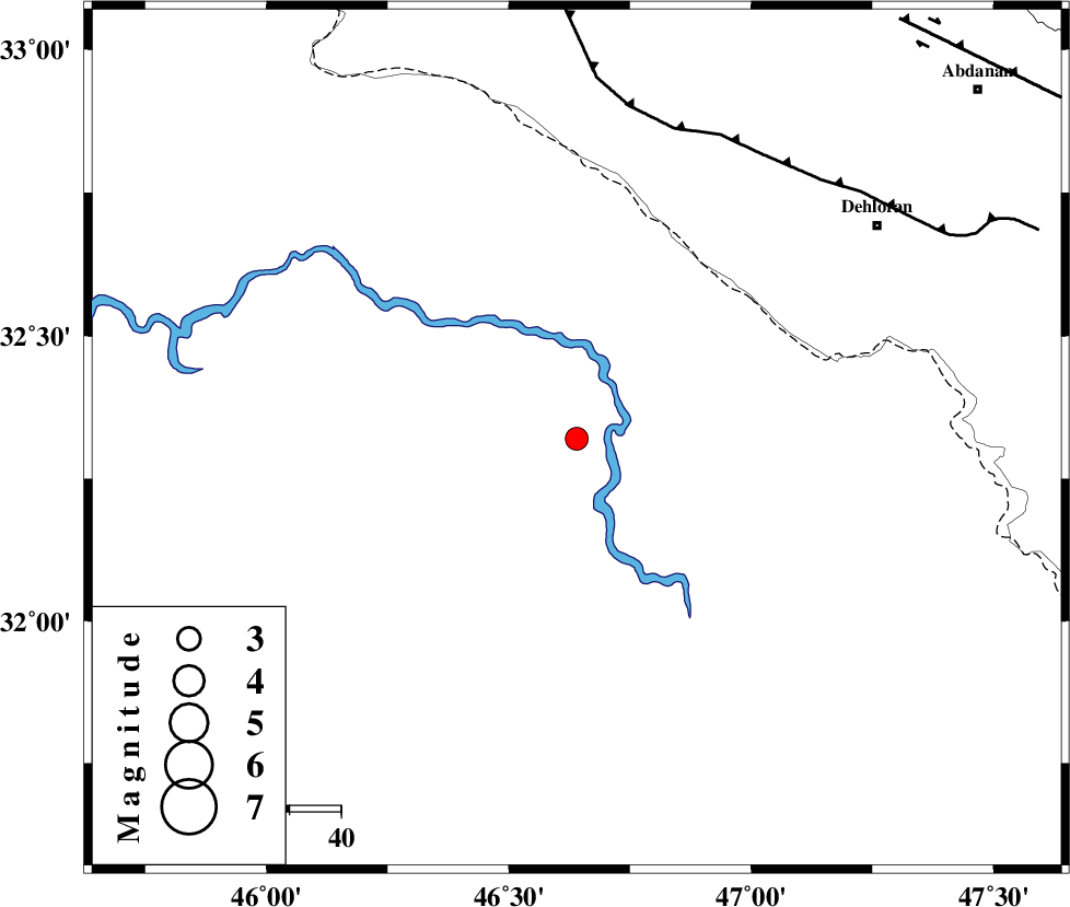
| Location | Lat:32.32 Lon: 46.64 |
| Region | Iraq, 72 km South-West of Dehloran |
Nearest Cities |
|
| 64 km South West of Bishehzar, Ilam Province | |
| 71 km South West of Dehloran, Ilam Province | |
| 72 km South West of Musian, Ilam Province | |
| 99 km South East of Mehran, Ilam Province | |
| 103 km South West of Abdanan, Ilam Province | |
| Depth | 41 km |
| Agency | |
Faults within 150 km: |
|
| MFF6 (Length: 144 km) , Distance to epicenter: 63 km | |
| ZFF4 (Length: 128 km) , Distance to epicenter: 94 km | |
| BALARUD_F_Z1 (Length: 87 km) , Distance to epicenter: 103 km | |
| Number of Phases | 6 |
| RMS | 0.1 |
| Number of Stations | 5 |
| Error in Latitude | >9.6 km |
| Error in Longitude | 5.7 km |
| Error in Depth | 6.7 km |
Download waveform in seisan format
to download seisan software Click here
to access information about IIEES stations Click here
Amplitude | ||||||||
| UID | Agency | Station | Component | Amplitude | Period | Arrival Time | Proccessing Time | Signal Clip |
| 83413 | IIEES | SHGR | E | 157.3 | 0.43 | 2012-05-09 07:20:36 | 2012-05-09 08:04:00 | n |
| 83414 | IIEES | SNGE | E | 62.6 | 0.6 | 2012-05-09 07:21:01 | 2012-05-09 08:04:00 | n |
| 83415 | IIEES | SNGE | N | 46.4 | 0.44 | 2012-05-09 07:21:04 | 2012-05-09 08:04:00 | n |
Phase | ||||||||||||
| Agency | Station | Component | Phase Type | Phase Quality | First Motion | Observed Arrival Time | Time Residual | Loc. Flag | Input Weight | Distance | Azimuth | |
| IIEES | SHGR | Z | Pg | E | 2012-05-09 07:20:03 | 0.01 | y | 205 | 96 | |||
| IIEES | SHGR | E | Sg | E | 2012-05-09 07:20:27 | -0.01 | y | 205 | 96 | |||
| IIEES | SNGE | Z | Pn | E | 2012-05-09 07:20:14 | -0.02 | y | 315 | 12 | |||
| IIEES | KHMZ | Z | Pn | E | 2012-05-09 07:20:18 | -0.13 | y | 348 | 62 | |||
| IIEES | ASAO | Z | Pn | E | 2012-05-09 07:20:25 | 0.05 | y | 400 | 51 | |||
| IIEES | GHVR | Z | Pn | E | 2012-05-09 07:20:36 | 0.13 | y | 491 | 59 | |||