
Magnitude |
:3.5 |
| Date & Time (UTC) | 2012-05-02 19:15:11.2 |
| Date & Time (Local) | 1391/2/13 23:45:11.2 |
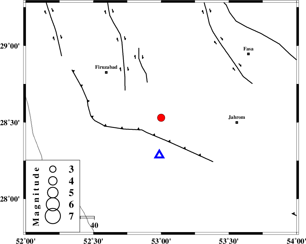
| Location | Lat:28.53 Lon: 53 |
| Region | Fars Province, 8 km Qir va Karzin |
Nearest Cities |
|
| 8 km North of Qir va Karzin, Fars Province | |
| 14 km North West of Fathabad, Fars Province | |
| 14 km South of Shaghun, Fars Province | |
| 15 km North of Shahrak-e jonubi, Fars Province | |
| 20 km South of Duzeh, Fars Province | |
| Depth | 18 km |
| Agency | |
Faults within 150 km: |
|
| QIR_F (Length: 130 km) , Distance to epicenter: 15 km | |
| SABZ_PUSHAN_F_Z2 (Length: 24 km) , Distance to epicenter: 27 km | |
| SABZ_PUSHAN_F_Z1 (Length: 69 km) , Distance to epicenter: 33 km | |
| Number of Phases | 7 |
| RMS | 0.1 |
| Number of Stations | 7 |
| Error in Latitude | >3.6 km |
| Error in Longitude | 2 km |
| Error in Depth | 4.2 km |
Download waveform in seisan format
to download seisan software Click here
to access information about IIEES stations Click here
Amplitude | ||||||||
| UID | Agency | Station | Component | Amplitude | Period | Arrival Time | Proccessing Time | Signal Clip |
| 83203 | IIEES | GHIR | E | 8000.8 | 0.44 | 2012-05-02 19:15:28 | 2012-05-02 08:09:00 | n |
| 83204 | IIEES | GHIR | N | 6328.1 | 0.52 | 2012-05-02 19:15:31 | 2012-05-02 08:09:00 | n |
| 83205 | IIEES | AHRM | E | 920.9 | 0.6 | 2012-05-02 19:16:10 | 2012-05-02 08:09:00 | n |
| 83206 | IIEES | AHRM | N | 945.9 | 0.56 | 2012-05-02 19:16:13 | 2012-05-02 08:09:00 | n |
| 83207 | IIEES | GHVR | N | 13.4 | 0.6 | 2012-05-02 19:18:12 | 2012-05-02 08:09:00 | n |
| 83208 | IIEES | GHVR | E | 12.7 | 0.56 | 2012-05-02 19:18:14 | 2012-05-02 08:09:00 | n |
Phase | ||||||||||||
| Agency | Station | Component | Phase Type | Phase Quality | First Motion | Observed Arrival Time | Time Residual | Loc. Flag | Input Weight | Distance | Azimuth | |
| IIEES | AHRM | Z | Pg | E | 2012-05-02 19:15:39 | 0.01 | y | 171 | 283 | |||
| IIEES | BNDS | Z | P | E | 2012-05-02 19:16:00 | -0.02 | y | 336 | 111 | |||
| IIEES | BNDS | N | Sg | E | 2012-05-02 19:16:45 | -0.02 | y | 336 | 111 | |||
| IIEES | KRBR | Z | Pn | E | 2012-05-02 19:16:08 | 0.12 | y | 399 | 65 | |||
| IIEES | GHVR | Z | Pn | E | 2012-05-02 19:16:43 | -0.09 | y | 681 | 346 | |||
| IIEES | TABS | Z | Pn | E | 2012-05-02 19:16:44 | 0.05 | y | 690 | 34 | |||
| IIEES | SHRT | Z | Pn | E | 2012-05-02 19:17:09 | -0.2 | y | 897 | 49 | |||