
Magnitude |
:1.5 |
| Date & Time (UTC) | 2012-04-29 14:56:30.1 |
| Date & Time (Local) | 1391/2/10 19:26:30.1 |
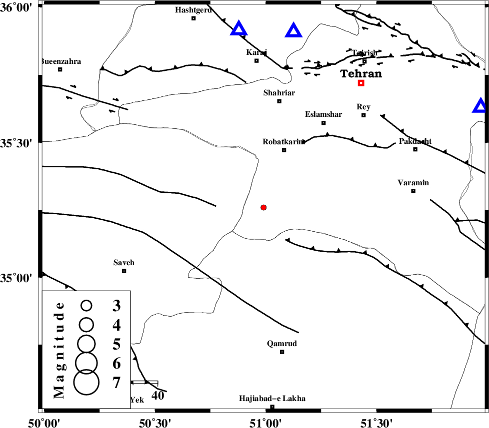
| Location | Lat:35.26 Lon: 50.99 |
| Region | Tehran Province, 26 km South of Robatkarim |
Nearest Cities |
|
| 25 km South of Robatkarim, Tehran Province | |
| 26 km South West of Vahnabad, Tehran Province | |
| 30 km South East of Rahimabad, Markazi Province | |
| 32 km South of Manjilabad, Tehran Province | |
| 38 km South of Joqin, Tehran Province | |
| Depth | 40 km |
| Agency | |
Faults within 150 km: |
|
| SIAHKUH_F (Length: 154 km) , Distance to epicenter: 17 km | |
| S_PARANDAK_F (Length: 116 km) , Distance to epicenter: 19 km | |
| KAHRIZAK_F (Length: 44 km) , Distance to epicenter: 31 km | |
| Number of Phases | 5 |
| RMS | 0 |
| Number of Stations | 3 |
| Error in Latitude | >1.2 km |
| Error in Longitude | 2 km |
| Error in Depth | 9.6 km |
Download waveform in seisan format
to download seisan software Click here
to access information about IIEES stations Click here
Amplitude | ||||||||
| UID | Agency | Station | Component | Amplitude | Period | Arrival Time | Proccessing Time | Signal Clip |
| 83179 | IIEES | GHVR | E | 19.2 | 0.24 | 2012-04-29 14:56:57 | 2012-04-30 02:49:00 | n |
| 83180 | IIEES | ASAO | E | 8.4 | 0.24 | 2012-04-29 14:57:05 | 2012-04-30 02:49:00 | n |
Phase | ||||||||||||
| Agency | Station | Component | Phase Type | Phase Quality | First Motion | Observed Arrival Time | Time Residual | Loc. Flag | Input Weight | Distance | Azimuth | |
| IIEES | CHTH | Z | Pg | E | 2012-04-29 14:56:43 | 0 | y | 73.4 | 10 | |||
| IIEES | GHVR | Z | Pg | E | 2012-04-29 14:56:45 | -0.05 | y | 89.4 | 164 | |||
| IIEES | GHVR | E | Sg | E | 2012-04-29 14:56:57 | 0.03 | y | 89.4 | 164 | |||
| IIEES | ASAO | Z | Pg | E | 2012-04-29 14:56:50 | 0.05 | y | 118 | 228 | |||
| IIEES | ASAO | E | Sg | E | 2012-04-29 14:57:04 | -0.03 | y | 118 | 228 | |||